Main impacts are expected in Quang Tri, Ha Tinh and Nghe An provinces.
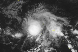
As updated by the National Center for Hydro-Meteorological Forecasting, at 6 a.m. on September 28, the eye of storm No. 10 was located at about 16.2 degrees North latitude and 109.7 degrees East longitude, approximately 360 kilometers east-southeast of northern Quang Tri and about 150 kilometers east of Da Nang City.
The storm is generating sustained winds at level 12 (equivalent to 118-133 kilometers per hour), with gusts reaching level 15 ( equivalent to 167-183 kilometers per hour), and is tracking west-northwest at about 25 kilometers per hour.
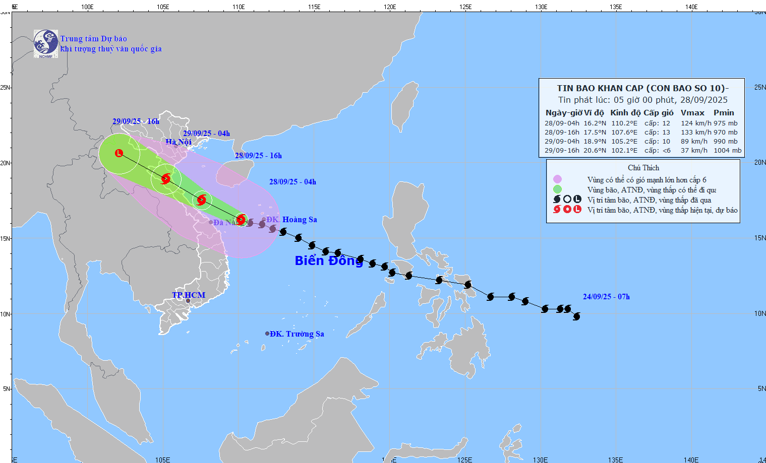
Vietnam’s meteorological agency expects the storm’s center to be over the waters from Nghe An to Quang Tri, with winds strengthening to level 12–13 (equivalent to 118-149 kilometers per hour) and gusts up to level 16 (equivalent to 184-201 kilometers per hour), by the afternoon of September 28. This system may intensify further and persist west-northwest at approximately 30 kilometers per hour.
From tonight, September 28, through early September 29, the storm will continue moving west-northwest at 25–30 kilometers per hour, make landfall in Thanh Hoa to Ha Tinh provinces, then weaken to category 9–10 (equivalent to 75-102 kilometers per hour), gusts up to force 13 (equivalent to 134- 149 kilometers per hour).
According to the weather forecast bulletin issued by the U.S. Joint Typhoon Warning Center (JTWC) at 4 a.m. on September 28 (Vietnam time), storm Bualoi (known as Opong in the Philippines, typhoon No. 20 in Japan and storm No. 10 in Vietnam) is approaching the central coast of Vietnam with very strong winds and dangerous developments.
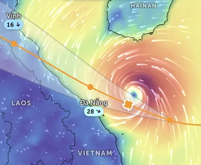
At 4 a.m., the storm’s center was located about 246 kilometers east of Da Nang, moving westward at 28 kilometers per hour. Waves near the storm’s center were reported as high as 8.5 meters.
Forecasts indicate that within the next 12 hours, the storm will skim along the coastal waters of Hue–Quang Tri before making landfall in the North Central region. The storm’s center is likely to strike northern Quang Tri Province between the night of September 28 and early September 29.
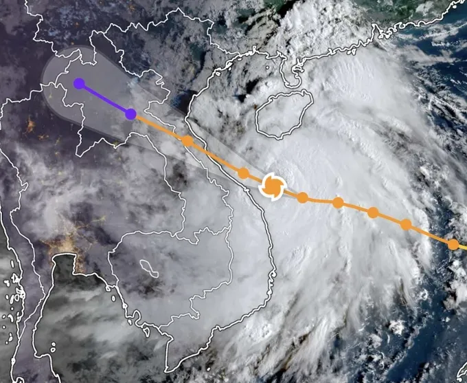
The JTWC assesses that the storm could reach peak intensity of 150–165 kilometers (equivalent to category 13 on the Vietnamese scale) as it nears the central coast of Vietnam.
The storm is classified as a powerful typhoon, with the potential to unleash damaging winds, heavy downpours, flash floods, landslides and life-threatening storm surges along coastal zones.
After moving further inland over Vietnam, the tropical storm is expected to downgrade and gradually dissipate over northern Laos within 48 hours.
The JTWC has warned that residents from Hue to northern Quang Tri should are urged to remain on high alert for powerful winds, intense rainfall and the threat of extensive flooding, especially as the storm comes ashore tonight, September 28.
