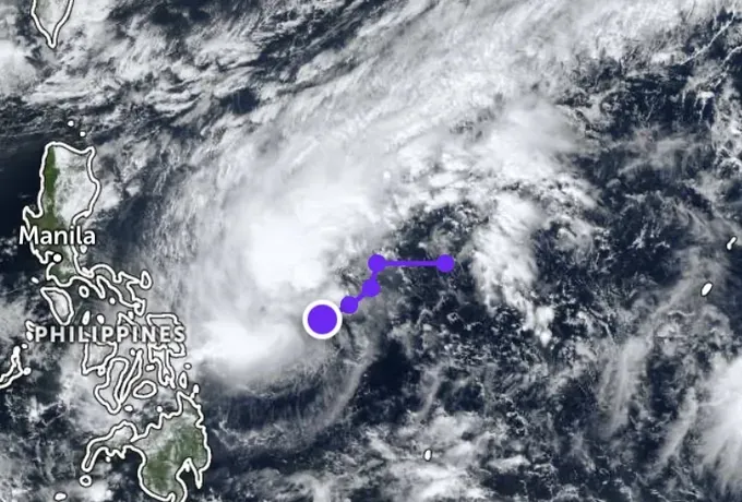
At a regular press conference held on the morning of December 4 in Hanoi by the Ministry of Agriculture and Environment, a representative of the Department of Meteorology and Hydrology reported that a tropical depression had formed over the eastern waters off the central Philippines and is moving slowly toward the north-northwest.
The Vietnam Meteorological and Hydrological Administration forecasts that between December 6 and 7, the tropical depression is likely to move across the central Philippines into the East Sea, where it is expected to intensify into a tropical storm, the 16th storm of the year.
The storm could subsequently have a direct impact on the Central and South-Central coast, bringing moderate to heavy rainfall from Hue City to Khanh Hoa Province.
The Department of Meteorology and Hydrology also noted that in December 2025, the Central and South-Central regions are likely to experience one to two rounds of widespread moderate to heavy rainfall. Precipitation levels from southern Quang Tri to the northern part of the South-Central Coastal region are expected to be higher than the long-term average.
In December 2025, cold-air masses are expected to increase in both frequency and intensity, potentially bringing severe and prolonged cold spells to the Northern region, particularly in the Northern mountainous areas. These cold-air outbreaks are forecast to remain strong through January and February 2026, likely causing additional periods of harsh, bitterly cold weather.


