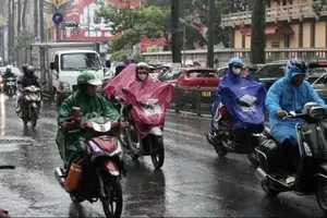
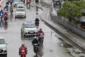
On the afternoon of September 22, Deputy Prime Minister Tran Hong Ha signed an urgent directive from the Prime Minister, calling on ministries, agencies and localities to proactively respond to super typhoon Ragasa, which is the ninth storm in the East Sea this year.
According to the National Center for Hydro-Meteorological Forecasting, Ragasa has now entered the eastern waters of Luzon Island, the Philippines and is expected to move into the East Sea later on the same day.
By September 25, the typhoon may directly impact coastal provinces from Quang Ninh to Ha Tinh.
Meteorologists warned that the storm is extremely intense with a vast reach, generating hazardous gusts, thunderstorms and squalls even although its center stays 300–400 kilometers off the coast.
Amid the unpredictable developments of typhoon Ragasa, the Prime Minister has ordered ministries, agencies and localities to respond promptly and proactively with readiness for all scenarios.
Preparations must be in place for worst-case scenarios to safeguard lives and minimize damage to public and private property.
The Prime Minister tasked ministers and chairpersons of provincial and municipal people’s committees from Quang Ngai northward to strengthen storm preparedness, review and refine response plans, with special focus on coastal areas from Quang Ninh to Quang Ngai, where severe winds are forecast.
Local leaders of Quang Ninh, Hai Phong, Hung Yen, Ninh Binh, Thanh Hoa, Nghe An, Ha Tinh, Quang Tri and Hue have been instructed to postpone non-essential working sessions and focus all efforts on directing the response to the super typhoon.
The Prime Minister ordered authorities to call on and guide vessels to safe shelters, impose sea bans when necessary, and restrict or control transportation during the storm’s impact to prevent accidents.
The Ministry of National Defense and the Ministry of Public Security are tasked with mobilizing forces and equipment to support evacuations and conduct rescue operations when required.
Meanwhile, the Ministry of Education and Training and the Ministry of Health must ensure the safety of students, staff and medical facilities; and healthcare and learning activities during the storm.
The Prime Minister also urged local authorities and residents to stay updated with weather forecasts and stay alert to all possible storm-related scenarios.
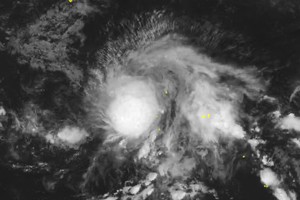
As updated by the National Center for Hydro-Meteorological Forecasting, as of 1 a.m. on September 21, typhoon Ragasa was located at approximately 17.7 degrees North latitude and 127.8 degrees East longitude, about 600 kilometers east of Luzon Island, the Philippines. The strongest winds near the storm’s center reached category 13 (134–149 kilometers per hour), with gusts up to category 16 (184-20 kilometers per hour).
The typhoon is moving northwest at a speed of 10–15 kilometers per hour.
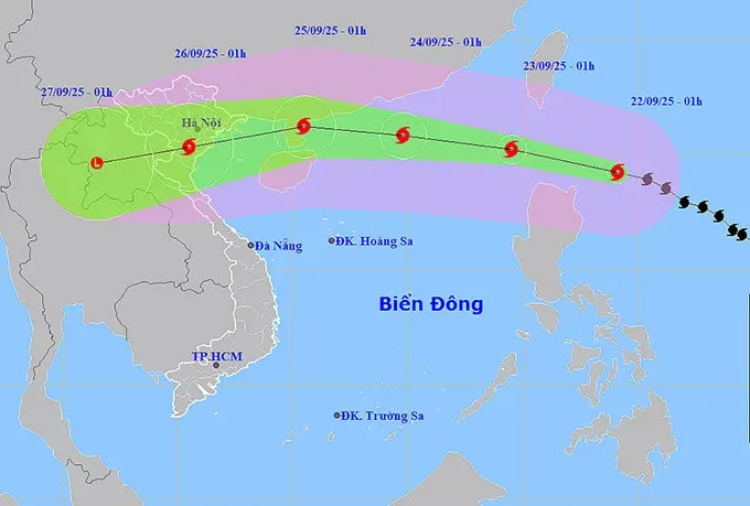
Forecasts indicate that by September 22, typhoon Ragasa will continue to intensify to category 14–15 (150-183 kilometers per hour), with gusts exceeding category 17 (202-220 kilometers per hour) as it will be about 240 kilometers northeast of Luzon Island.
By September 23, Ragasa is expected to become a super typhoon, category 16, with gusts exceeding category 17 in the northern waters off Luzon Island. The dangerous area in the East Sea is defined as north of latitude 18 degrees and east of longitude 118 degrees. The disaster risk level has been raised to level 4.
On September 24, the typhoon is forecast to enter the northern East Sea, about 140 kilometers southeast of Hong Kong, sustaining category 16 winds with stronger gusts, before turning west-southwest and weakening gradually.
From the afternoon of September 22, the northeastern East Sea will see category 6–7 winds (39-61 kilometers per hour), later increasing to category 8–9 (62-88 kilometers per hour) with gusts up to category 11 (103-117 kilometers per hour).
By the night of September 22, areas near the storm center will experience category 14–16 winds, gusting above category 17, waves higher than 10 meters, and extremely rough seas, posing a severe hazard to marine vessels.
The National Center for Hydro-Meteorological Forecasting urged local authorities, agencies and fishermen to monitor super typhoon Ragasa’s development closely and take proactive measures to minimize damage from the typhoon.
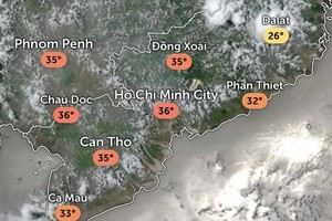
On land, Northern Vietnam, the Central Highlands and Southern Vietnam are expected to experience showers and thunderstorms, with rainfall amounts ranging from 15 mm to 30 mm, locally over 100 mm. The South-Central coastal region, including Da Nang City, will experience scattered showers and thunderstorms, with rainfall ranging from 10 to 30 mm, occasionally exceeding 70 mm.
During thunderstorms, risks of whirlwinds, lightning, hail and strong gusts are possible, along with intense rainfall of over 70 mm within three hours, which may trigger flash floods, landslides and localized flooding.
