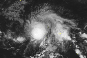
As of the morning of September 21, international meteorological agencies reported that typhoon Ragasa (called Nando in the Philippines) was very strong over the waters east of Luzon Island.
As updated by the National Center for Hydro-Meteorological Forecasting of Vietnam, on early Sunday morning, September 21, the storm’s center was located at 17.7 degrees North latitude and 127.8 degrees East longitude, about 600 kilometers east of Luzon Island.
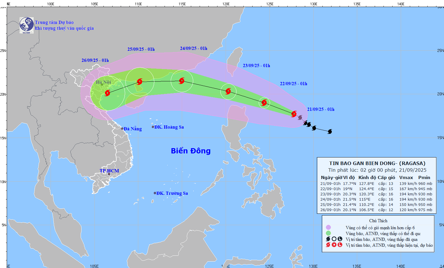
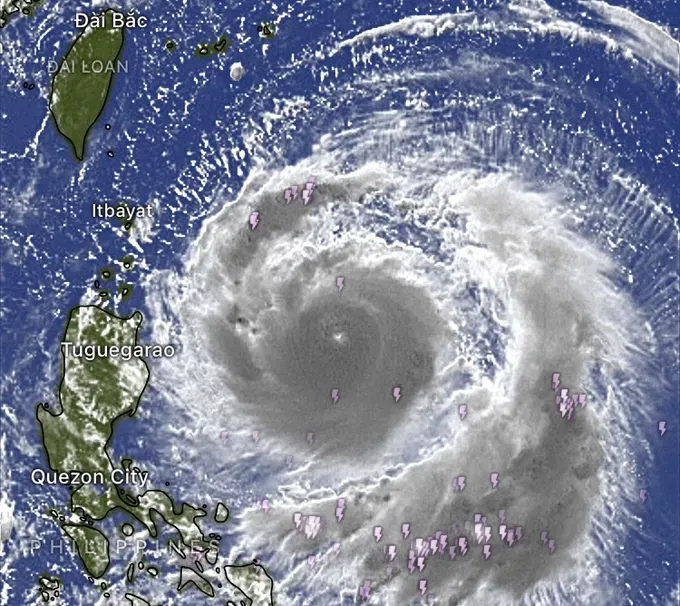
According to international meteorological agencies, after 7 a.m. on September 21, winds near typhoon Ragasa’s center reached level 16 on the Beaufort scale (184-201 kilometers per hour), with gusts above level 17 (202-220 kilometers per hour).
Forecast models from the United States, Europe and Japan show that Ragasa is expected to intensify into a super typhoon in the next 12–24 hours, and the storm is tracking west-northwest at 15 kilometers per hour.
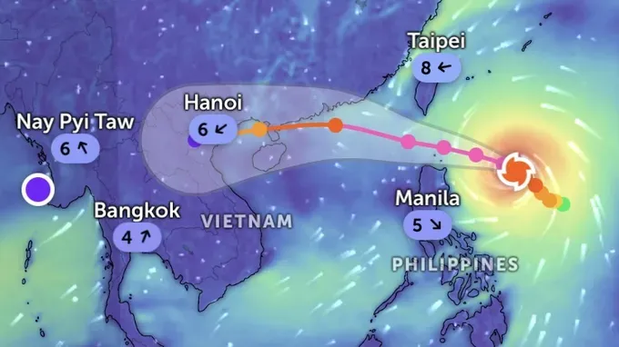
On September 22 and September 23, the storm is likely to cross northern Luzon Island before moving into the East Sea.
After crossing the Philippines, Ragasa may persist with very strong intensity for two or three days before gradually weakening as it interacts with mainland China or is affected by other atmospheric systems such as a cold high-pressure ridge.
However, some Vietnamese meteorologists noted that Ragasa’s movement is shaped more by high-altitude winds than by surface-level cold air above 700 hPa.
As of the night of September 20 (Vietnam time), several major international forecast models have revised Ragasa’s projected path compared with earlier outlooks.
Current scenarios mostly indicate the storm will shift west, crossing China’s Leizhou Peninsula before moving into the Gulf of Tonkin around September 25. Several models indicate a high probability of landfall in Vietnam.
Some models, including those from the JMA (Japan Meteorological Agency) and the ECMWF (European Center for Medium-Range Weather Forecasts), indicated the storm could approach Northern Vietnam with sustained winds of level 11–12 (103-133 kilometers per hour) and gusts reaching level 14 (150-166 kilometers per hour).
If the typhoon shifts northward, wind and rainfall impacts would likely ease; however, a more southerly track could bring greater impacts to the north-central coast.
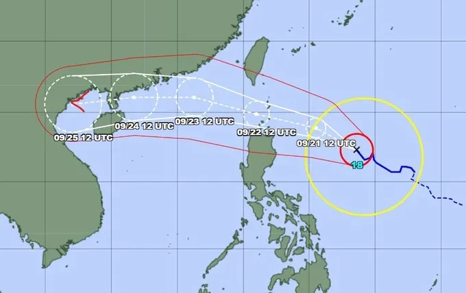
Global numerical weather prediction models such as the GFS (Global Forecast System) from NOAA (National Oceanic and Atmospheric Administration, U.S.); ICON (Icosahedral Nonhydrostatic), Germany; the ECMWF (European Center for Medium-Range Weather Forecasts), Europe; as well as warnings from the JTWC (U.S. Joint Typhoon Warning Center) and the JMA (Japan Meteorological Agency), showed similar projections for Ragasa’s track and its potential to maintain intensity.
Forecast scenarios indicated that in the coming days, Ragasa’s circulation could bring extremely strong winds and heavy rain to northern Philippines before moving into the East Sea and affecting coastal provinces in Northern and North-Central Vietnam.
Meteorologists noted that this is a super typhoon with an unpredictable track and many uncertain factors. Residents are recommended to stay updated in case the storm makes landfall in Vietnam.
