In recent days, Ho Chi Minh City experienced heavy rain combined with high tides, causing flooding on many streets and making travel difficult for residents, especially during peak hours.
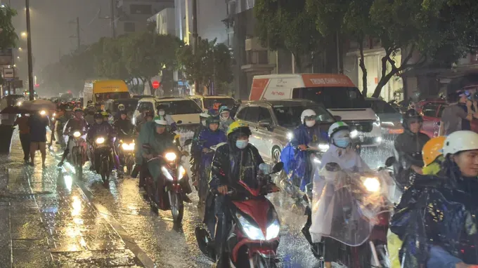
In particular, on the late afternoon of September 30, heavy rain poured down right at rush hour, causing severe traffic congestion in many areas and stalling numerous vehicles.
Resident Nguyen Quang in Tan Thang Street in Tan Son Nhi Ward said that his commute from work at the Bay Hien intersection to his home normally takes about 20 minutes, but on the afternoon of September 30, it took him more than 1 hour and 30 minutes due to flooded roads and traffic chaos.

Resident Huynh Minh Nga on Vo Van Ngan Street, Thu Duc Ward, added that many deeply flooded streets prevented him from returning home. On To Ngoc Van Street, just about 10 minutes after the heavy rain started, water rose above vehicle wheels; the intersection with Linh Dong Street was severely flooded with fast-flowing water. Many vehicles stalled, forcing residents to assist each other in pushing their vehicles through the flooded point.
According to the Center for Transport and Infrastructure Management in Ho Chi Minh City (TIMC) under the HCMC Department of Construction, 12 streets were flooded after the rain on the afternoon of September 30, including: Ho Hoc Lam and Ten Lua in An Lac Ward, Phan Anh in Binh Tri Dong Ward, Quang Trung from Thong Tay Hoi Ward to Dong Hung Thuan Ward, Pham Van Chieu, Nguyen Van Khoi, Le Duc Tho in Thong Tay Hoi Ward, parallel roads of National Route 22 and Nguyen Van Qua in Dong Hung Thuan Ward, Ba Trieu in Hoc Mon Commune, Phan Huy Ich in Tan Son Ward, and Phan Van Hon in Ba Diem Commune.
For Phan Huy Ich Street, the flooding situation worsened compared to previous years. The main reason was that during the construction of the Tham Luong - Ben Cat - Nuoc Len Canal Improvement Project, the construction unit accumulated dredged waste inside the canal bed, narrowing the flow.
By the morning of October 1, more than 15 hours after the heavy rain, many residential areas on Street No. 11, Thu Duc Ward, HCMC, remained deeply flooded.
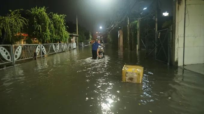
Speaking to SGGP Newspaper reporters, a representative of the Thu Duc Ward People's Committee stated that through inspection, heavily flooded points were concentrated in Alley 66, Alley 84, and Alley 114 on Street No. 11. At times, the water rose to about waist level for adults, affecting movement and daily activities of households. Meanwhile, the Street No. 4 area also experienced flooding, but to a lighter degree.
The HCMC Department of Construction reported that the city currently has 116 locations and routes forecasted to be at risk of flooding due to heavy rain and tides, including 71 routes at risk of flooding from rain, with 23 routes facing potential severe flooding.
Multiple flood prevention measures are implemented
According to Director Nguyen Xuan Vinh of the the Center for Transport and Infrastructure Management in Ho Chi Minh City, in the immediate term, the city is focusing on effectively exploiting the existing drainage system. Units are stepping up the dredging of sewers, discharge outlets, and canals; maintaining degraded sewers; and deploying personnel to be on duty before, during, and after rains. When flooding occurs, functional forces organize pumping, regulate flow, direct traffic, and restrict vehicles from entering deeply flooded areas.
Early warning work is also being enhanced, especially when heavy rain coincides with high tides. In 2026, HCMC is implementing 9 flood prevention projects with a total capital of over VND7,150 billion (US$286 million), prioritizing the immediate handling of 3 out of 50 flooded locations with water levels of 30cm or higher lasting over 30 minutes. The three priority locations include Phan Van Hon Street, Binh Quoi Street, and the intersection of National Route 51 and Huynh Thuc Khang Street.
Speaking to SGGP Newspaper reporters, Deputy Director of the HCMC Department of Construction Le Ngoc Linh said that for the 2026-2030 period, the city expects to implement 87 drainage and flood prevention projects with total funding of about VND140,000 billion to fundamentally solve 50 flooded locations. The city is currently facing simultaneous impacts from extreme rain, high tides, sea level rise, land subsidence, and rapid urbanization. Subsidence averages about 2.5cm per year; nearly 400 canals are encroached upon or littered, affecting drainage capacity.
In the long term, HCMC is shifting from tackling individual points to basin-based flood management through three layers of solutions: slowing down flow, increasing storage capacity with retention basins and green spaces, and finally discharging water. The city aims to protect natural drainage corridors, develop wetland parks, apply digital data, and improve forecasting and early warnings.
Along with that, tide control projects, dikes, embankments, and the completion of the drainage network are expected to enhance flood resistance. The goal is to establish a synchronized urban water management system and boost Ho Chi Minh City's adaptability to extreme rain, high tides, land subsidence, and climate change.
On the evening of October 1, heavy rain coinciding with high tide and rush hour caused deep flooding and severe traffic congestion across Ho Chi Minh City. Residents struggled to make their way home, as the downpour during peak hours made travel extremely difficult for countless vehicles.
On streets such as Phan Dinh Phung in Phu Nhuan Ward, Dien Bien Phu and No Trang Long streets in Binh Loi Trung Ward, dense traffic crawled forward inch by inch.
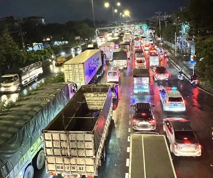
The Do Muoi Street area (the section passing through An Phu Dong and Thoi An wards) experienced a traffic jam stretching from the Vuon Lai - Do Muoi intersection to the Nga Tu Ga Bus Station.
Beyond traffic jams, flooding occurred in many locations. On Dien Bien Phu Street as well as inside Alley 602, water levels ranged from 20cm to over 50cm, forcing residents to dismount and walk their vehicles.
On Nguyen Xi Street in Binh Loi Trung Ward, traffic was chaotic due to the combination of flooding and congestion. Almost all alleys in the Nguyen Xi Street area were flooded, making movement very difficult for residents. On Pham Ngu Lao Street in Thu Dau Mot Ward, heavy rain combined with a rising high tide caused floodwaters to spill over the banks, reaching depths of up to 50cm. Numerous vehicles stalled, forcing residents to struggle as they pushed their bikes through the water.
Floodwaters surged into homes in low-lying areas along rivers and canals. Many residents reported that this was the most severe flooding since the start of the rainy season.











)