As reported by the National Center for Hydro-Meteorological Forecasting on the morning of June 11, the tropical depression over the eastern waters of the Paracel Islands has intensified into a storm, officially becoming storm No. 1 in the East Sea in this year’s hurricane season.
The storm, internationally named Wutip, is also the first storm to form in the Northwest Pacific region this year.
")
At 7 a.m. on June 11, the storm was located at approximately 16.1 degrees North latitude and 113.7 degrees East longitude, about 220 kilometers southeast of the Paracel Islands. The maximum sustained wind speed near the eye of the storm was at level 8 (62–74 kilometers per hour), with wind gusts up to level 10 (89-102 kilometers per hour).
The storm is moving slowly northwestward at a speed of about 5–10 kilometers an hour, and it is expected to intensify further over the next one or two days.
Forecasts for the next 24–72 hours showed that the tropical storm would move northwestward, then gradually shift northward before approaching the southern part of Hainan Island (China) by the morning of June 13 with its maximum sustained winds reaching level 10 (89–102 kilometers per hour) and gusts up to level 13 (134–149 kilometers per hour).
By the morning of June 14, the storm is forecast to gradually downgrade in the area near Leizhou Peninsula (China).
The National Center for Hydro-Meteorological Forecasting has issued a warning about dangerous conditions in the northern waters of the East Sea including the Paracel Islands, and the middle of and southern part of the East Sea comprising the Spratly Islands.
Wind gusts could be intense and reach level 6–7 (40-61 kilometers per hour) and level 8–11 (62-117 kilometers per hour) near the center of the storm, along with huge waves ranging from three to five meters, and rough sea enough to cause significant damage for vessels.
Therefore, all vessels operating in dangerous areas are recommended to closely monitor the developments of the storm, and take necessary precautions against strong winds, high waves and the risk of cyclones at sea.
In related news about the newly-formed storm, throughout the morning of June 11, widespread torrential rainfall has persisted in multiple areas of Hue City under the pre-storm circulation of tropical storm No. 1.

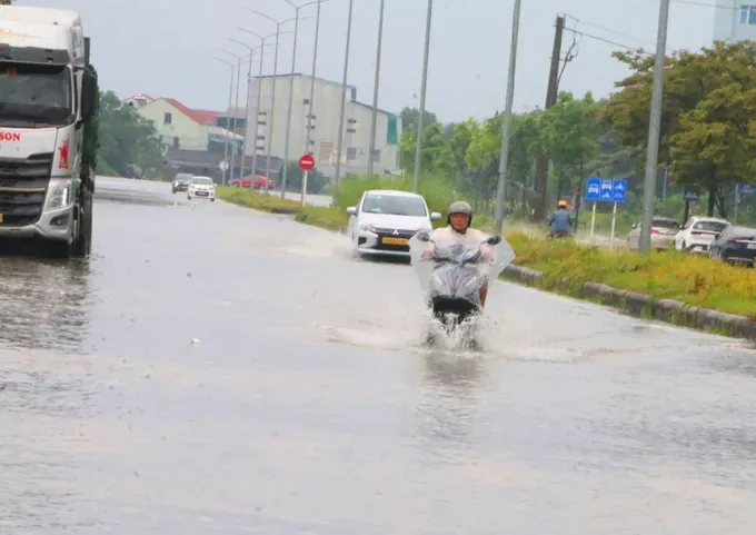
The stagnant rainwater has led to localized waterlogging in low-lying areas of Phu Xuan and Thuan Hoa wards.
Authorities are monitoring the situation and urging residents in flood-prone areas to stay alert and take precautions for rising water levels.
In several low-lying areas, many residents had to urgently move their cars to higher ground to prevent them from getting damaged.
The Steering Committee for Natural Disaster Prevention and Search and Rescue of Hue City reported that in response to tropical storm No. 1, the unit issued an emergency directive to instruct relevant units about guiding vessels operating at sea to move promptly to safe shelter; conducting 24/7 emergency duty to respond promptly to any disaster-related developments.


