Thanks to proactive preparedness, no major damage was reported.
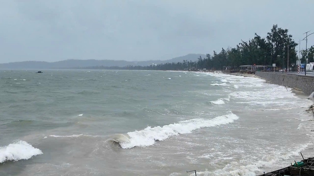
According to the National Center for Hydro-Meteorological Forecasting (NCHMF), winds near the storm’s eye reached levels 9–10, exceeding 100 km/h, with gusts up to level 13, accompanied by widespread heavy rainfall.
On Co To Special Zone, heavy rains and strong winds from the night of July 21 through early July 22 caused widespread power outages, complicating response efforts, particularly at evacuation shelters and rescue facilities. Authorities swiftly deployed backup generators at key facilities, including medical stations, local government offices, and evacuation centers, while maintaining round-the-clock readiness to manage any arising emergencies and ensure residents' safety.


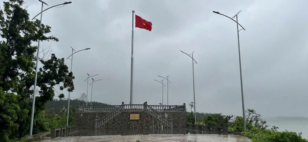
By 7 a.m., Co To Party Secretary Le Ngoc Han confirmed, “Co To is safe after Storm No.3.” She noted that from dawn, local authorities had been steadily reporting “all clear” updates. “It was deeply moving to receive images of the national flag flying at the sovereignty post on Thanh Lan Island—home to nearly 2,000 residents and isolated from the main Co To Island. We are grateful for the support and encouragement from everyone, which strengthened our resolve to weather the storm. All villages and islands remain safe, and no significant damage has been recorded,” she said.
In neighboring Van Don Special Zone, winds and rain subsided early in the morning. By 7 a.m., there were no casualties reported, though some trees and billboards were knocked down in residential areas and along major roads. Local authorities have dispatched teams to inspect, document, and handle any incidents.

In central Quang Ninh, including Ha Long, Hong Gai, and Bai Chay, moderate rain and winds of level 5–6, with gusts up to level 7, persisted into the morning. Several trees and signboards were toppled, but no casualties were reported.

To ensure safety, authorities had banned motorcycles and rudimentary vehicles from crossing Bai Chay Bridge since the evening of July 21 due to gusts reaching level 7–8. By 7:45 a.m., as winds eased, barriers were removed, and traffic resumed, though officials continued urging caution and adherence to safe distances and speeds.
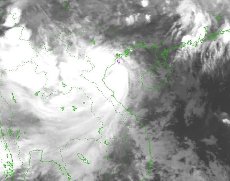
At 8:30 a.m., winds began howling across Hanoi. Meteorologists reported that as of 7:50 a.m. on July 22, storm Wipha had weakened while still over the Hai Phong–Ninh Binh offshore waters and was gradually shifting southward.
According to Mr. Hoang Phuc Lam, Deputy Director of the NCHMF, the storm’s center at 7 a.m. was located off the coasts of Hai Phong and Ninh Binh. Sustained winds remained at level 9 with gusts up to level 12, moving slowly West-Southwest at about 15 km/h.
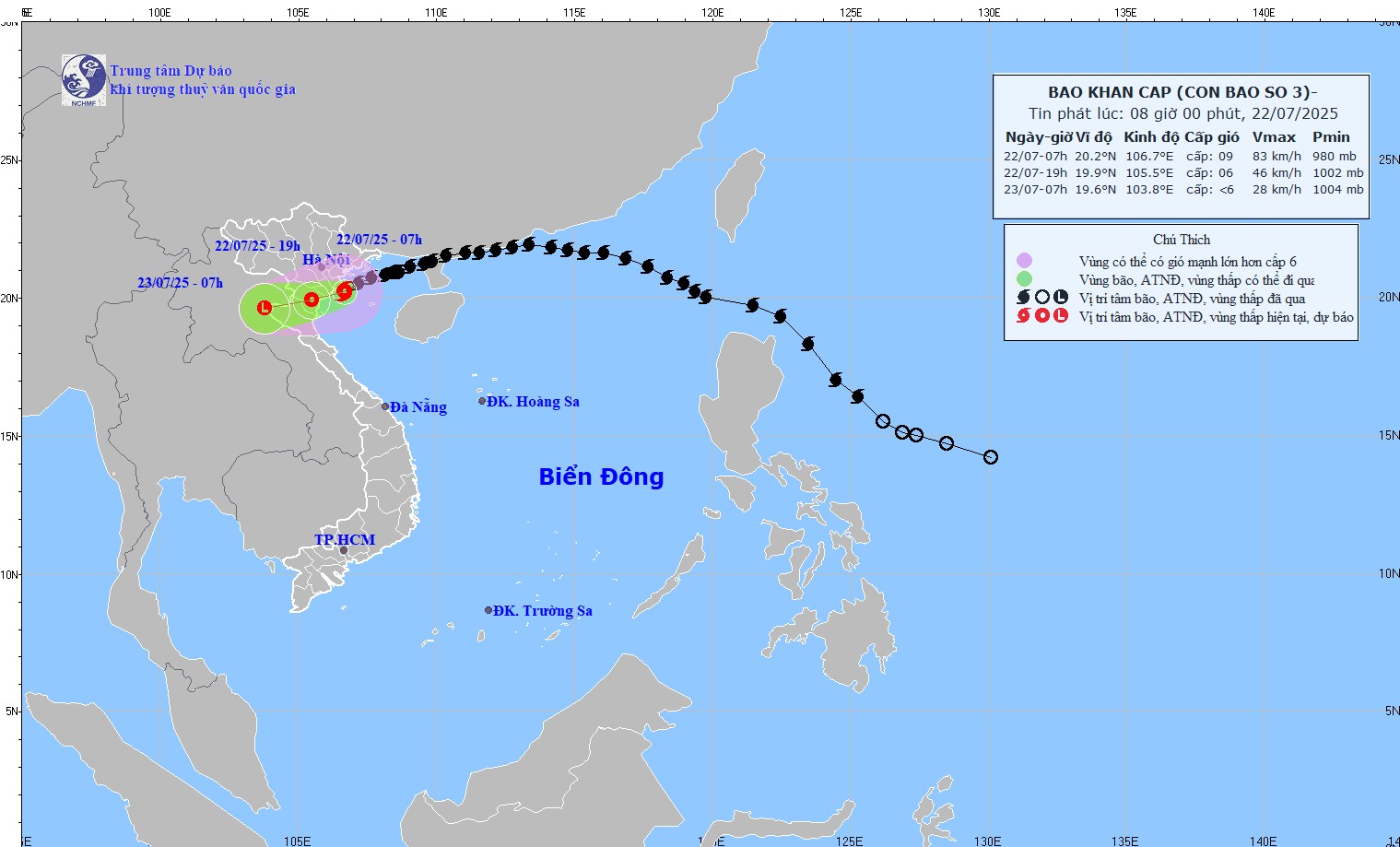
Forecasts indicate the storm will move into the Hung Yen–Ninh Binh area before weakening further into a tropical depression, affecting inland areas from Hai Phong to Thanh Hoa.
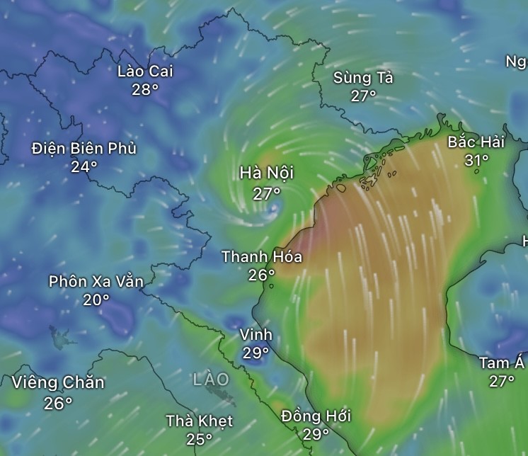
By the morning of July 22, as the storm veered southward from the Gulf of Tonkin and approached land, the risk of flash floods and landslides had escalated sharply in multiple provinces, particularly mountainous areas of Thanh Hoa and Nghe An, throughout July 22 and into the night.
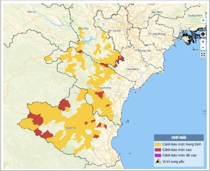
Mr. Nguyen Huu Huynh, a senior NCHMF meteorologist, warned that in the past 12 hours, Phu Tho, Thanh Hoa, and Nghe An had already experienced moderate to torrential rainfall.
Significant downpours were recorded in Van Mai (Phu Tho) at 115 mm, Thach Quang (Thanh Hoa) at 95 mm, and Muong Long (Nghe An) at 69 mm. Soil moisture models indicate many areas in these provinces have reached near-saturation or full saturation, with moisture levels exceeding 85 percent.
In the next three to six hours, rainfall in these regions could surpass 100 mm in places, with heightened risks of landslides, flash floods, and waterlogging.


The Vietnam Meteorology and Hydrology Administration continues to issue warnings of severe rain, flooding, and landslides in areas impacted by the storm. From July 22 to 23, the Northern Delta, Thanh Hoa, and Nghe An are expected to receive heavy to torrential rains with thunderstorms, with accumulations ranging from 100–200 mm and locally exceeding 300 mm.
Other parts of the Northern region and Ha Tinh are forecast to see moderate to heavy rainfall, with totals of 50–100 mm and localized peaks above 150 mm.
The director of the NCHMF warned that Hanoi would experience strong winds around noon. Residents of high-rise buildings were advised to brace for wind amplification effects.
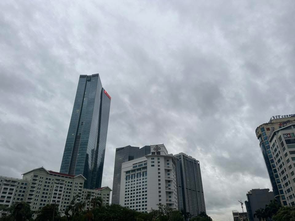
Between 4 a.m. and 7 a.m., Hanoi remained calm, with overcast skies and no visible signs of the storm. However, according to NCHMF’s Director Mai Van Khiem, the capital is expected to face direct impacts from storm Wipha today, with strong winds and widespread heavy rainfall. Gusts may reach levels 7–8, while sustained winds remain at levels 5–6. Localized thunderstorms could also trigger sudden, powerful gusts in the inner city.

Mr. Mai Van Khiem cautioned that in areas densely packed with high-rise buildings, wind speeds could be amplified by one or two levels beyond official measurements, increasing risks for pedestrians and outdoor objects. Rainfall in Hanoi is forecast to range from 100 to 200 mm, with some areas exceeding 300 mm, potentially causing flooding in low-lying areas and major streets such as Pham Van Dong, Nguyen Xien, Nguyen Trai, Minh Khai, and Phan Boi Chau.
Flooding could reach depths of 20–50 cm and last 30 minutes to an hour before receding, provided no additional heavy rains occur. “Flooding will disrupt transportation, hinder daily activities, and pose significant safety risks in residential areas,” Mr. Mai Van Khiem warned.
He added that the national and regional meteorological centers were closely monitoring storm No.3’s movements hour by hour, issuing timely updates to support response and public warnings.
Early on July 22, the Vietnam Meteorology and Hydrology Administration under the Ministry of Agriculture and Environment also advised residents in urban areas of the Northern delta, especially Hanoi, to remain alert to intensified winds and tornado-like squalls during the storm. “Avoid going outdoors unless absolutely necessary,” the agency urged.
As of 6 a.m., the storm’s center was located about 170 km South-Southwest of Quang Ninh, 60 km Southeast of Hai Phong, 50 km East of Hung Yen, and 70 km Northeast of Ninh Binh. Vietnam’s meteorological agency forecasted winds at levels 9–10 with gusts up to level 13, while Japan’s meteorological agency expected the storm to strengthen to level 11; US agencies projected winds at level 10.
