On the afternoon of July 18, the Ministry of Agriculture and Environment hosted a working session focusing on storm Wipha response. Deputy Minister of Agriculture and Environment Nguyen Hoang Hiep presided over the working session in the capital city of Hanoi.
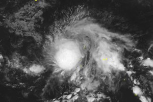
In his speech at the working session, Dr. Mai Van Khiem, Director of the National Center for Hydro-Meteorological Forecasting, stated that storm Wipha is likely to become storm No. 3 of this year’s hurricane season once it enters the East Sea on the morning of July 19.

As indicated by the Director of the National Center for Hydro-Meteorological Forecasting, storm Wipha is currently moving northwest at a speed of 20 kilometers per hour. As tracked, the storm is located about 200 kilometers east of Luzon Island, the Philippines, with maximum sustained winds of 117 kilometers per hour.
The system thrives in an environment characterized by warm sea surface temperatures, low wind shear, and abundant heat flux. It is likely to intensify to 133-183 kilometers per hour as it moves deeper into the East Sea.
Mr. Mai Van Khiem emphasized that storm Wipha’s predicted path and impact pattern would be relatively similar to those of typhoon Yagi in 2024, which brought widespread heavy rainfall to the Northern and North‑Central regions of Vietnam.
If storm Wipha maintains its current path, it could directly impact the localities from Quang Ninh to Nghe An, starting from the night of July 21 and July 22.
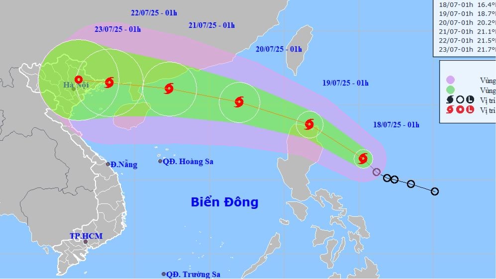
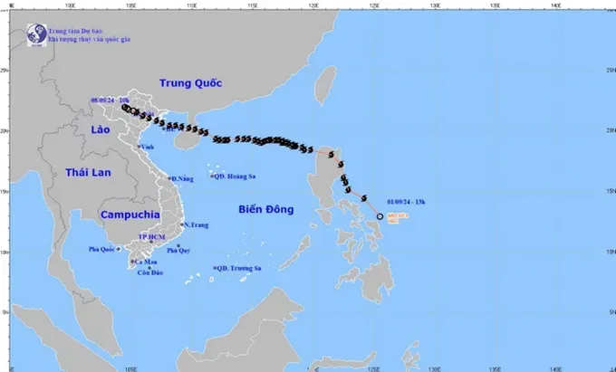
Under the impact of Wipha, rainfalls are forecast to range from 200mm to 350mm, exceeding 600mm in several areas, posing a high risk of flash floods, landslides, and flooding from July 21 to July 24.
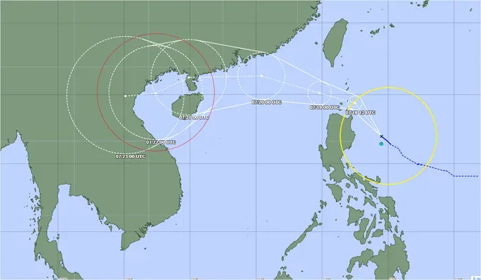
The National Center for Hydro-Meteorological Forecasting warned that in the worst-case scenario, the storm could make landfall with wind speeds of level 10–11 (89 kilometers to 117 kilometers per hour), gusting to level 15 (183 kilometers per hour), triggering widespread whirlwinds and heavy rainfall.
