However, numerous people claimed the agency failed to anticipate the severity of the event.
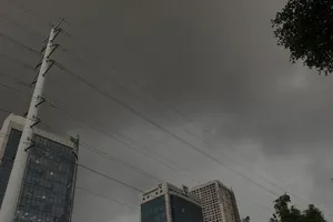
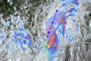
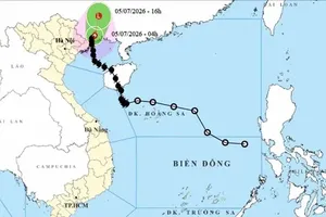
On the afternoon of July 19, an unexpectedly powerful windstorm accompanied by heavy rain, thunderstorms and whirlwinds passed across multiple northern provinces, including Hanoi, Quang Ninh, Lao Cai, Tuyen Quang and Thai Nguyen simultaneously.

Sudden, violent winds and downpour left people scrambling for safety, forcing vehicles to a halt in the middle of the road. Afterwards, social media was soon flooded with posts expressing shock and frustration, accusing the weather agency of failing to issue any prior warning.
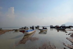
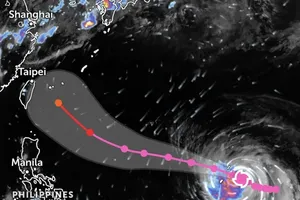
The most heartbreaking incident was the capsizing of the Vinh Xanh 58 tourist boat on Ha Long Bay in Quang Ninh Province, which was carrying 48 passengers and five crew members. The accident resulted in multiple fatalities, raising the question: “Why was the vessel allowed to depart despite warnings about tropical storm Wipha (storm No. 3)?”

Some sources claimed that when the vessel departed, the weather was calm, without any signs of thunderstorms or strong winds, and without storm warning at that time.
Some locals stated that the authorities only issued a boat ban starting on July 21, and predicted that storm Wipha was expected to hit directly on July 22, so locals did not take precautionary measures.
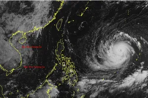
The National Center for Hydro-Meteorological Forecasting confirmed that the storm alerts were fully disseminated. At least two thunderstorm alerts were issued on July 19, one at 11:45 a.m. and another at 1:30 p.m.
The second alert specifically highlighted the potential for heavy rain and thunderstorms in the area of Ha Long Bay, where the accident occurred.
In the marine weather forecast news issued at 3:30 p.m. on July 18, the Quang Ninh Provincial Meteorological and Hydrological Station provided that on July 19, the Gulf of Tonkin region including the waters of Bai Chay and the Ha Long Bay area would experience scattered rain during the day, showers and thunderstorms at night, and rough seas, according to the National Center for Hydro-Meteorological Forecasting.

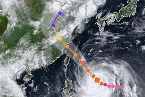
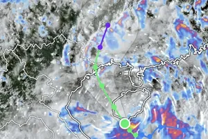
The meteorological agency explained that despite the storm’s center being over 1,000 kilometers away, a tropical supercell system formed by the intertropical convergence zone and prolonged high temperatures, triggering heavy rain, strong winds, and even hail. The phenomenon is not directly related to the pre-storm's circulation system.
Dr. Mai Van Khiem, Director of the National Center for Hydro-Meteorological Forecasting, affirmed that this is not a direct impact of storm No. 3 because the system is still far away and has not yet entered the Gulf of Tonkin.
The representative from the meteorological agency stated that forecasting thunderstorms remains a major challenge not only for Vietnam but also for weather agencies around the world, which often face similar criticism. This is a probabilistic science, so absolute accuracy is impossible.