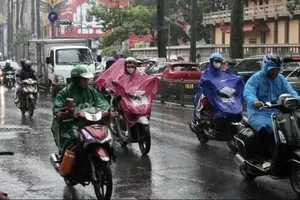
The Department of Meteorology and Hydrology under the Ministry of Agriculture and Environment announced on the morning of July 18 that the tropical storm is forecast to enter the East Sea on the night of July 19 and will become storm No. 3 of this year’s hurricane season.
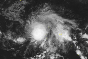
Currently, the storm is located about 200 kilometers east of Luzon Island, the Philippines. It sustained winds of 60 kilometers to 74 kilometers per hour.
Within the next 24 hours, the storm is forecast to make a west-northwest turn at a speed of 20 kilometers to 25 kilometers per hour.
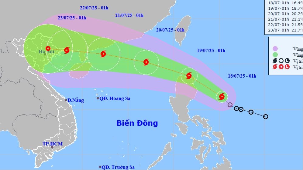
It is expected to intensify after entering the East Sea, possibly reaching approximately 100 kilometers to 135 kilometers per hour and directly impacting Vietnam’s mainland by July 22.
Meteorological experts have noted that the path of storm Wipha is relatively similar to that of storm Yagi, storm No. 3 in 2024.
According to the National Center for Hydro-Meteorological Forecasting, from July 21 to July 23, the Northern region and Thanh Hoa Province are expected to experience heavy to very heavy rainfall, posing a high risk of flash floods, landslides and localized flooding.
On the afternoon of July 18, the Deputy Minister of Agriculture and Environment will preside over an emergency working session with relevant ministries, agencies, and local authorities to discuss proactive measures to respond to the storm.
Meanwhile, several reservoirs in the Northern region are being operated under the inter-reservoir coordination protocol to create storage capacity for incoming floods.
Currently, Hoa Binh Hydropower Plant has opened three bottom spillway gates, while Tuyen Quang Hydropower Plant has opened one gate.
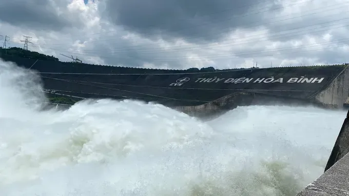
At 8 a.m. on the same day, the total discharge from the Hoa Binh reservoir to downstream was approximately 7,000 cubic meters per hour, while the inflow into the reservoir was around 4,000 cubic meters per hour.
Authorities recommended that people closely monitor the developments of storm Wipha in order to take proactive measures and minimize potential damage.
