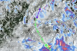
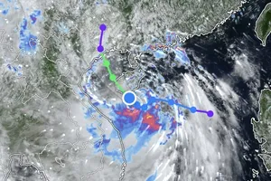
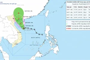
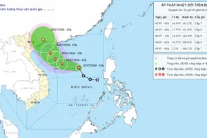
At that time, the storm was centered at approximately 16.2 degrees North latitude and 119 degrees East longitude over the eastern waters of the northern East Sea. The storm has intensified from level 8 (62-74 kilometers per hour) to level 10 (89–102 kilometers per hour), with gusts reaching level 12 (118–133 kilometers per hour).
")
Meteorologists reported that storm No.4 is moving east-southeast at a speed of about ten kilometers per hour. The storm has shown frequent shifts in direction.
On July 25, the storm is expected to move east-northeast, then northeast, heading toward northern Luzon Island, the Philippines, where it is forecast to downgrade gradually.
Although the Southern region will not be directly affected by storm-force winds, locals need to prevent rain, thunderstorms, whirlwinds and lightning triggered by the activated southwest monsoon.
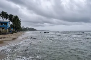
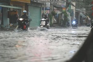
Under the influence of a low-pressure trough, the Northern and North-Central regions will continue to experience persistent rainfall events.