The storm, internationally known as Saudel, re-formed from the remnants of the same system after it had weakened following landfall in China.
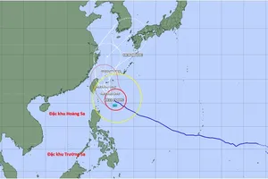
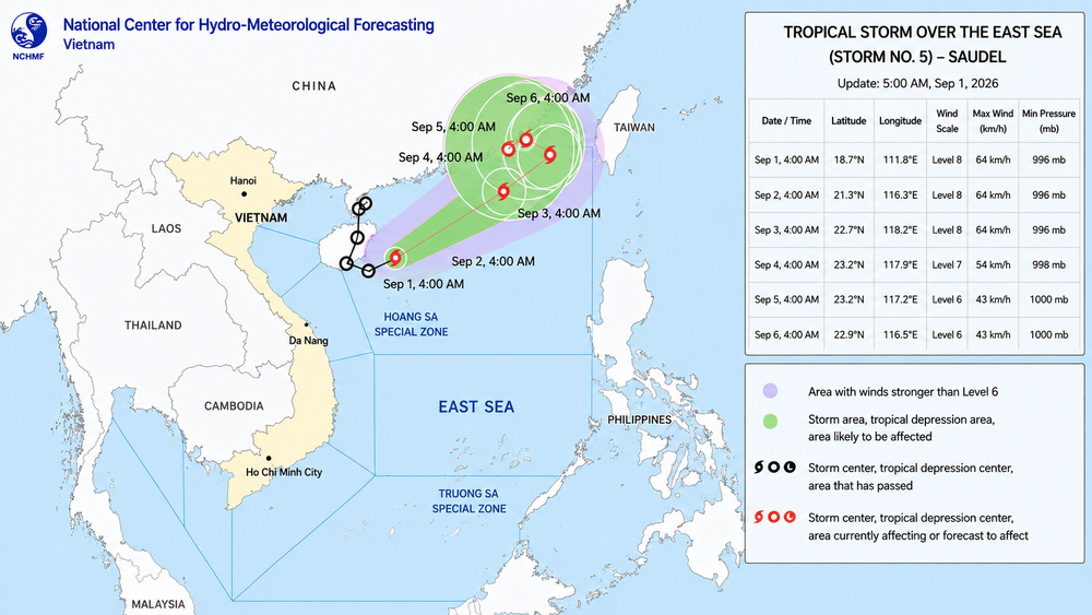
At 4 a.m. on September 1, the center of Saudel was located at about 18.7 degrees North latitude and 111.8 degrees East longitude, roughly 240 kilometers north of Vietnam's Hoang Sa Special Zone.
Maximum sustained winds near the storm's center were measured at 62-74 kilometers per hour, equivalent to level 8 on Vietnam's wind scale, with gusts reaching level 10. The storm was moving northeast at 15-20 kilometers per hour.
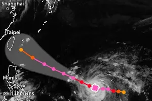
Forecasters expect Saudel to continue northeastward at 20-25 kilometers per hour over the next 24 hours. By 4 a.m. on September 2, its center is forecast to reach about 21.3 degrees North latitude and 116.3 degrees East longitude, over the northeastern waters of the northern East Sea. It is expected to maintain level-8 winds, with gusts of level 10.
The storm is forecast to continue northeast at 15-20 kilometers per hour through September 3, remaining at roughly the same intensity.
By early September 4, Saudel is expected to turn north-northwest and slow considerably to 3-5 kilometers per hour. It is forecast to weaken into a tropical depression over the waters south of China's Fujian Province, with winds dropping to level 7 and gusts reaching level 9.
The national weather agency warned of hazardous marine conditions across the northern East Sea, including waters around Hoang Sa Special Zone. Winds are currently reaching levels 6-7, with gusts of levels 8-9, while waves are between two and four meters high.
Near the storm's path, winds could reach level 8 with level-10 gusts, accompanied by waves of three to five meters and very rough seas. Vessels operating in affected waters face the risk of thunderstorms, tornadoes, powerful winds, and high waves.
Saudel initially developed over the northwestern Pacific before moving toward China and making landfall in Zhejiang Province on the morning of August 28. After moving inland, it weakened into a tropical depression and subsequently a low-pressure area.
Its remnants then tracked south toward Guangdong Province before moving offshore near the Leizhou Peninsula. The system regained strength and developed into a tropical depression on the morning of August 31.
Early on September 1, it intensified once again into a tropical storm, retaining the international name Saudel.