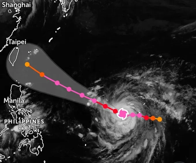
The storm had reached level 16 (184–201 km/h), with gusts exceeding level 17 (202–221 km/h), and was expected to maintain this intensity over the next two days. From October 21, it is forecast to gradually weaken to around level 15 (167-183 km/h), with gusts still exceeding level 17.
Vietnam’s hydro-meteorological agency assessed that Champi had only a 10–20 percent chance of entering the northeastern part of the East Sea. Meanwhile, there was an 80–90 percent probability that the storm would move northwestward before affecting Taiwan (China) and coastal areas of China. Japan, China, and the United States have issued similar forecasts, according to their respective storm forecasting centers.
Although Champi is unlikely to enter the East Sea, its circulation could strengthen winds over the northern part of the sea in the coming days, given its intensity of level 15, with gusts exceeding level 17. Around October 21, the storm’s western circulation is expected to begin affecting the northeastern part of the northern East Sea, bringing winds of level 6 (39–49 km/h). On October 23 and 24, northeasterly winds in the northern East Sea could strengthen to level 6 (39–49 km/h)—level 7 (50–61 km/h), with gusts reaching level 9 (75–88 km/h)—level 10 (89–102 km/h). Waves are forecast to reach 3–5 meters, with rough seas.













)