On September 28, the National Center for Hydro-Meteorological Forecasting warned that sea levels along the Southern region were running high.
At the Vung Tau station in Ho Chi Minh City, the highest water level had reached 4 meters and was forecast to rise to 4.05 meters on September 29. Under normal conditions, the high tide at the station is around 3.47-3.57 meters.
The Southern Regional Hydro-Meteorological Station forecast that high tide in Ho Chi Minh City would peak on the afternoon of September 29. Water levels could exceed alert level III, with the peak coinciding with evening rush hour, increasing the risk of flooding and traffic congestion.
The national hydro-meteorological agency said the high tide would slow flood drainage through the river system, affecting low-lying and riverside areas as well as areas along canals in Ho Chi Minh City and several other localities in southern Vietnam. Tide levels are expected to decline after September 29 but remain high through October 3.
According to the Southern Regional Hydro-Meteorological Station, water levels at most stations along the Saigon River are rising rapidly during the full-moon high-tide cycle of the eighth lunar month. The current tide is forecast to peak between 6 a.m. and 8 a.m. and between 5 p.m. and 7 p.m. on September 28, 29, and 30.
At the Phu An and Nha Be stations, peak water levels are forecast at 1.60-1.65 meters, around or approximately 3 centimeters above alert level III.
At the Thu Dau Mot station, water levels could reach 1.75-1.85 meters, or 15-25 centimeters above alert level III.
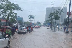
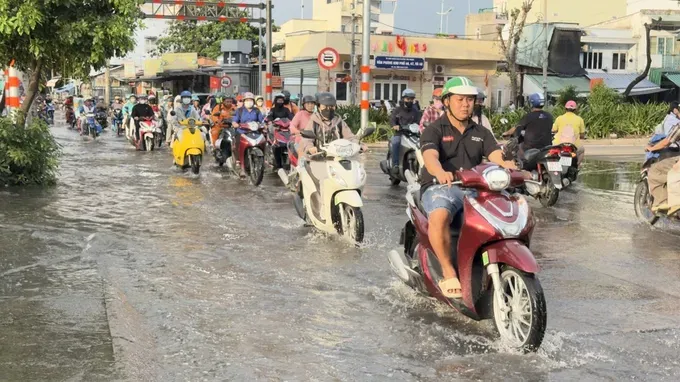
At around 4:30 p.m. on September 28, high tide on the Tan Thuan River rose sharply, with water beginning to spill onto Tran Xuan Soan Street, which runs through Tan Thuan and Tan Hung wards in Ho Chi Minh City. The flooding caused significant difficulties for vehicles traveling through the area.
The Can Tho Hydro-Meteorological Station forecast that the high tide in Can Tho City could reach 2.28 meters on the evening of September 29, 0.28 meters above alert level III. It advised residents to closely monitor developments and limit travel through low-lying and deeply flooded areas during periods of high tide.
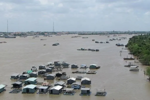
At the Can Tho station, the water level recorded on the morning of September 28 showed the high tide on the Hau River reaching 2.23 meters, about 23 centimeters above alert level III.
Rising tides have pushed water into low-lying areas that are not yet enclosed by dikes, causing widespread flooding in parts of the city center.
In particular, sections of National Highway 91 and roads in the Binh Thuy and Ninh Kieu areas along the Hau River were deeply flooded, with some locations under more than 0.5 meters of water, disrupting residents' daily activities, travel, and trade.

)