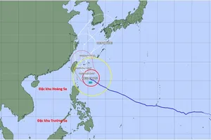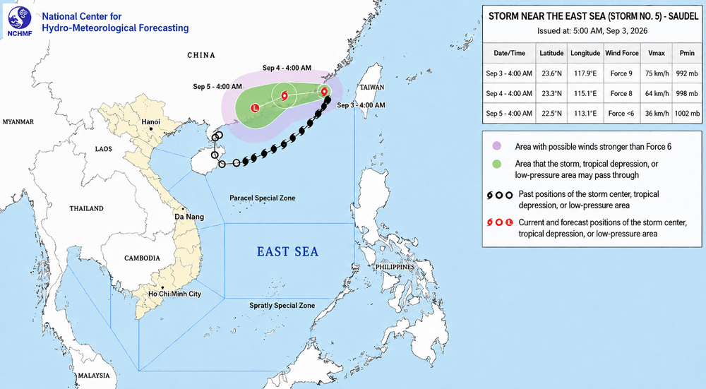
At 4 a.m., the storm's center was located near 23.6 degrees North and 117.9 degrees East, over waters northeast of the northern East Sea. Maximum sustained winds near its center were estimated at 62-88 kilometers per hour, with gusts reaching level 11 on Vietnam's wind scale.
The storm has shifted course from its trajectory on September 1 and 2 and is now moving west-northwest at around 10 kilometers per hour.
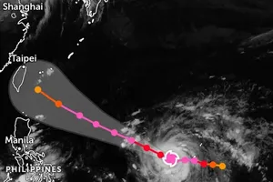
Forecasters expect the system to turn west-southwest and accelerate to 10-15 kilometers per hour through September 4. By the morning of September 4, its center is forecast to reach southeastern Guangdong Province in China, with maximum winds at level 8 and gusts at level 10. The storm is expected to gradually weaken after making landfall.
From September 4 to the morning of September 5, the system is forecast to continue moving west-southwest at about 10 kilometers per hour. It is expected to reach southern Guangdong before weakening into a tropical depression and later degenerating into a low-pressure area.
Although the storm's center is moving away from the East Sea, its circulation will continue to generate hazardous marine conditions in northern waters.
On September 3 and 4, northeastern parts of the northern East Sea are forecast to experience winds of level 6-7, with gusts of level 8-9 and waves two to four meters high.
Areas near the storm's path could see level-8 winds, gusts of level 10, and waves reaching three to five meters, resulting in very rough seas.