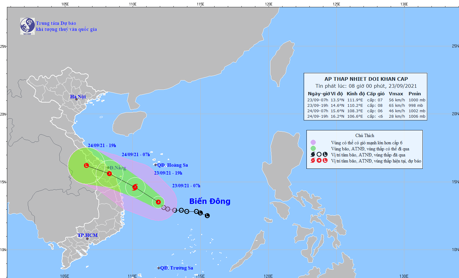
In the next 24- 48 hours, the system will move west-northwest at a speed of 15- 20 kilometers per hour and bear down the mainland provinces from Thua Thien-Hue to Binh Dinh before being downgraded to the tropical depression.
Apart from the Central provinces from Ha Tinh to Binh Dinh, from Thanh Hoa to Nghe An, the system is going to bring thundery downpours across the Central Highlands provinces of Kon Tum, Gia Lai along with risks of flash floods, flooding and landslides in the low-lying and riverside areas from now to this weekend.
As of this morning, the tropical low-pressure system was at around 13.5 degrees north latitude and 111.9 degrees east longitude, at about 280 kilometers, 290 kilometers and 500 kilometers far from coastal areas of Phu Yen, Binh Dinh Province and Da Nang City respectively.
The tropical depression has triggered gusty winds of level 6-10, big waves of 2-4 meters and rough sea in the offshore from Quang Tri to Binh Dinh including the island districts of Con Co, Ly Son and Cham Islands (Cu Lao Cham), the territorial waters from Ninh Thuan to Ca Mau.