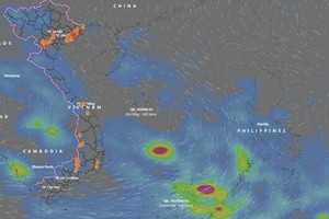
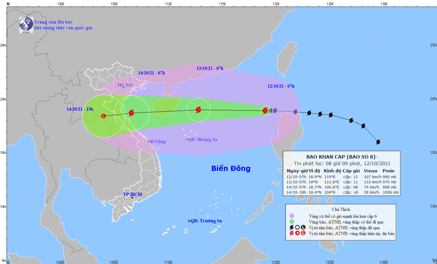
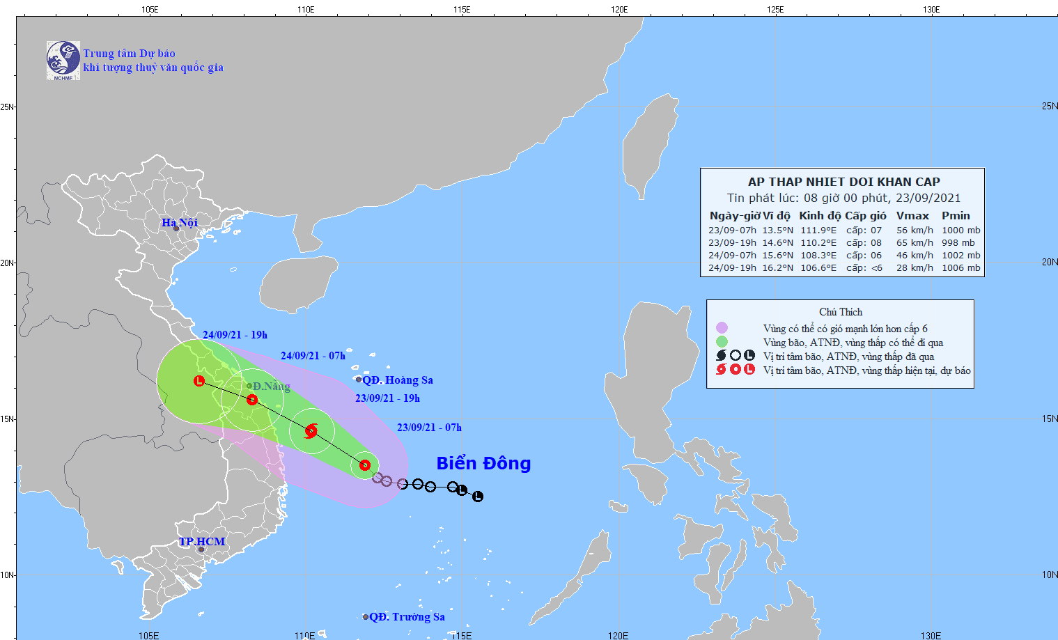
The latest weather news from the National Center for Hydrology Meteorology Forecasting showed that storm Nalgae will downgrade into a tropical depression and a low-pressure zone in a row on the western territorial water of the north- East Sea in next 48-72 hours; and it is expected to slam unlikely the mainland of Vietnam.
The General Department of Meteorology and Hydrology under the Ministry of Natural Resources and Environment held a workshop in the capital city of Hanoi on June 16 to update further forecast information, tendency, intensity and frequency of rains, floods and storms in the upcoming months, aiming to help functional agencies, local authorities and people proactively deal with the natural disasters and minimize damage from downpours and floods.
Throughout the first day of this month, the North-Central and Mid-Central experienced medium-heavy rains, reported the National Center for Hydro-meteorological Forecasting.
The National Center for Hydrology Meteorology Forecasting said that one more cold wave has moved to the Northern region, yesterday affecting the Mid-Central region.
Meteorologists of the National Center for Hydrology Meteorology Forecasting warned that a tropical low-pressure system may be expected to form in the middle of the East Sea on January 27 (the 25th day of the last month of the lunar calendar) but it would not affect the mainland.
According to the Standing Office of the National Steering Committee for Natural Disaster Prevention and Control, the local authorities of provinces from Quang Nam to Khanh Hoa are preparing to evacuate over 65,000 households with more than 258,000 people amid the worst flooding at a record level of over level 3 due to prolonged downpours.
Kompasu, the eighth storm of this year’s hurricane season in the East Sea, is expected to rapidly move west at its speeds of 25 to 30 kilometers per hour and will intensify in the next 24 hours.
A tropical depression formed yesterday afternoon in the middle of the East Sea and is expected to strengthen into a storm in the next 24 hours, said the National Center for Hydrology Meteorology Forecasting.
Typhoon Dianmu downgraded into a low-pressure zone this morning, but its circulation has brought torrential rains along with blustery winds in the territorial waters from Quang Tri to Quang Ngai and the mainland provinces from Thua Thien- Hue to Quang Nam.
The National Center for Hydrology Meteorology Forecasting predicted that an ongoing tropical depression is likely to intensify to a storm nearby the coastal areas of Phu Yen, Binh Dinh Province and Da Nang City with gusty winds of 60-75 kilometers an hour this evening.
While the Southern region and Ho Chi Minh City are facing a scorching wave with the highest temperature of 34 degrees Celsius, the Northern region is forecast to experience a cold air mass.