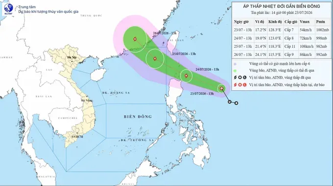
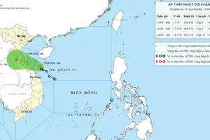
As of July 23, the system was centered at approximately 17.2 degrees North latitude and 128.3 degrees East longitude, over the waters east of the Philippines, about 600 km east of Luzon Island. Maximum sustained winds near its center were at level 7 (50-61 km/h), with gusts reaching level 9 (75–88 km/h). The tropical depression was moving northwest at around 25 km/h.
By the afternoon of July 24, the tropical depression is forecast to strengthen into a tropical storm, with maximum sustained winds of level 8 (62–74 km/h) and gusts up to level 10 (89–102 km/h). Late on July 24 or early July 25, the storm is expected to enter the northeastern waters of the northern East Sea. By the afternoon of July 25, it is forecast to intensify further to level 10 (89- 102 km/h) - level 11 (103–117 km/h), with gusts reaching level 13 (134 – 149 km/h), while remaining over the northeastern part of the northern East Sea.
The Meteorological and Hydrological Administration estimates there is an approximately 80 percent chance that the storm will make landfall in Guangdong Province, China, on July 26, making a direct impact on mainland Vietnam unlikely.
However, from the evening of July 24, winds over the northeastern waters of the northern East Sea are expected to strengthen gradually from levels 6 (39–49 km/h) to 7 before increasing to levels 8-9. Areas near the storm's center could experience winds of levels 10-11, with gusts up to level 13, accompanied by waves 3-5m high and very rough seas. Vessels operating in the affected waters are at risk from thunderstorms, waterspouts, strong winds, and high waves.
According to the National Center for Hydro-Meteorological Forecasting, as the storm moves into the northern East Sea, the southwest monsoon over the Southern region is expected to strengthen, while a low-pressure trough across the central region becomes more active, resulting in increased rainfall across the Southern region. Widespread moderate rain is forecast, with localized heavy to very heavy downpours. Thunderstorms may also bring whirlwinds, lightning, and strong gusts. Rain is expected mainly in the afternoon, evening, night, and early morning. Increased cloud cover and persistent rain are likely to lower daytime temperatures by about 2-3 degrees Celsius, resulting in cooler conditions.










)