Storm Noul will mark the second storm to enter the East Sea this year and the 12th recorded in the Northwest Pacific basin.
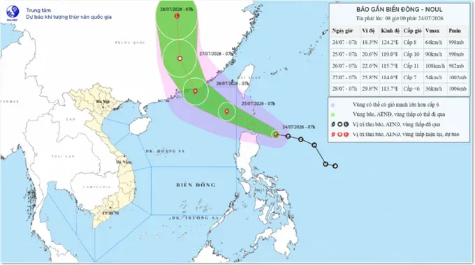
As of 7:00 a.m. on July 24, the storm’s center was located at approximately 18.3 degrees North latitude and 124.2 degrees East longitude, about 210 kilometers east of Luzon Island in the Philippines. Maximum sustained winds near the center reached level 8 (62–74 km/h), with gusts up to level 10 (89–102 km/h). The storm is moving west-northwest at a speed of around 25 kilometers per hour.
Forecasters warn that Storm Noul is likely to strengthen further over the next 24 hours. By 7:00 a.m. on July 25, as it tracks into the northeastern East Sea, wind speeds are projected to reach level 9 (75–88 km/h) to level 10 (89–102 km/h), with gusts peaking at level 12 (118- 133 km/h).
The storm is expected to intensify to level 10 (89–102 km/h) or level 11 (103–117 km/h)—with gusts up to level 13 (134 – 149 km/h)—by the morning of July 26 as it approaches the coastal waters of China's Guangdong province. After making landfall, the system is forecast to gradually weaken into a tropical depression over mainland China by July 27.
Experts from the National Center for Hydro-Meteorological Forecasting estimate an 80 percent probability that Storm Noul will make landfall in China’s Guangdong province, making direct impacts on the Vietnamese mainland unlikely.
However, over the next 24 to 48 hours, the northeastern waters of the East Sea will face the direct force of the storm.
Beginning late Thursday afternoon, winds in the northeastern East Sea are forecast to intensify to levels 6 (39–49 km/h)–7 (50–61 km/h), eventually reaching levels 8–9. Near the storm's center, winds could escalate to levels 10–11, with gusts reaching level 13. Seas will be rough with waves rising 4 to 6 meters high. Weather authorities have warned vessels operating in these hazardous areas of extreme risks from thunderstorms, tornadoes, gale-force winds, and high seas.
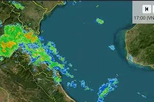
On land, officials urged heightened vigilance across the Northern region due to heavy rainfall. On Wednesday night, July 23, several regions recorded moderate- to heavy-downpours, with precipitation generally ranging from 30 to 70 mm and exceeding 70 mm in some areas. Heavy rainfall was logged in Minh Quang Commune, Tuyen Quang Province, at 121 mm; Dai Phuc Commune, Thai Nguyen Province, at 120 mm; and Phu Ninh Commune, Phu Tho Province, at 88 mm. Continuous rain was reported across Hanoi and neighboring regions on Thursday morning.
Meteorologists forecast that the Northern region will continue to experience moderate to heavy rain and thunderstorms from July 24 to 25, with rainfall amounts ranging between 40 and 100 mm, and localized pockets exceeding 200 mm.
While water levels along northern rivers currently remain below Alert Level 1, inflows into the Tuyen Quang and Thac Ba reservoirs are expected to rise over the next 24 to 48 hours. Floodwaters on the upper reaches of the Thao, Chay, Lo, Cau, and Thuong rivers could reach Alert Levels 1 and 2, with some areas surpassing Alert Level 2.




)