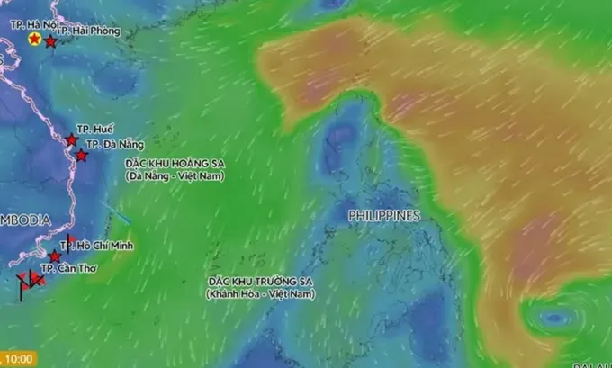
As of 7 a.m. on January 14, the system had sustained winds of force 7, with gusts reaching force 9.
The tropical depression is forecast to move west-northwest over the next 24 hours and may strengthen into a typhoon, potentially becoming the first storm of the 2026 season in the northwestern Pacific. It is then expected to turn northward and track along the eastern waters of the Philippines.

According to Mr. Mai Van Khiem, Director of the National Center for Hydro-Meteorological Forecasting, the storm is unlikely to move into Vietnam’s waters as a cold air mass is currently dominating the East Sea region. It is expected to weaken and dissipate over the northeastern waters of the Philippines around January 19 and January 20. Authorities are closely monitoring its development.
The center also noted that the period through February 10 marks the peak of the northeast monsoon season, with strong monsoon winds affecting both marine and inland weather conditions.
During this time, the probability of storm or tropical depression formation over the East Sea remains low.


