")
According to the National Center for Hydro-Meteorological Forecasting, specifically, the Southern region is forecast to remain dry and sunny over the three days. Daily lows are expected to range between 23 and 26 degrees Celsius, while highs will hover between 31 and 35 degrees. In parts of the Southeast region, temperatures could climb above 35 degrees Celsius.
In the Northern region, light rain is forecast in isolated areas on February 20. Morning hours are likely to see scattered mist and light fog, while mountainous areas may experience intermittent drizzle. Conditions are expected to turn cold in the early morning and at night. Temperatures are projected to range from 15 to 18 degrees Celsius at their lowest, dipping below 14 degrees in some mountainous locations. Daytime highs are forecast between 22 and 25 degrees, with parts of the Northwestern region potentially exceeding 27 degrees Celsius.
From February 21 to 22, northern localities are forecast to see light rain in isolated areas, accompanied by scattered morning mist and light fog. On February 22, mountainous and midland provinces may experience more widespread showers, with isolated thunderstorms possible. Cold conditions are expected to persist during the night and early morning hours.
Lowest temperatures during this period are projected to range between 17 and 20 degrees Celsius, dipping below 16 degrees in some mountainous areas. Daytime highs are forecast at 23 to 26 degrees, with parts of the Northwestern region potentially exceeding 28 degrees Celsius.
In Hanoi, from February 20 to 22, light rain is expected in some areas, along with scattered morning mist and light fog. The capital is likely to experience chilly conditions at night and in the early morning. Temperatures are forecast to range from 17 to 20 degrees Celsius at their lowest and from 23 to 26 degrees at their highest.
Provinces and cities from Thanh Hoa to Hue are forecast to see light rain in isolated areas from February 20 to 22. Early mornings are expected to bring scattered mist and light fog, with sunshine emerging by late morning and afternoon. On February 20, however, localities from Ha Tinh to Hue may experience more widespread showers. Northern parts of the region are likely to turn chilly at night and in the early morning hours.
Lowest temperatures are projected to range between 18 and 22 degrees Celsius. Daytime highs in the Northern region are expected at 23 to 26 degrees, while southern areas may see temperatures between 25 and 28 degrees, with some locations exceeding 28 degrees Celsius.
Along the South-Central Coast, from February 20 to 22, conditions are forecast to be mostly sunny during the day, with isolated evening showers. On February 20, areas from Da Nang to Khanh Hoa may experience scattered rain and possible thunderstorms. Temperatures in the region are expected to range from 21 to 25 degrees Celsius at their lowest and from 27 to 31 degrees at their highest, with southern localities potentially surpassing 31 degrees Celsius.
In the Central Highlands, from February 20 to 22, dry conditions and sunny skies are forecast to prevail. Overnight lows are expected to range between 16 and 20 degrees Celsius, dipping below 16 degrees in some areas. Daytime highs are projected at 28 to 31 degrees, with certain locations exceeding 31 degrees Celsius.
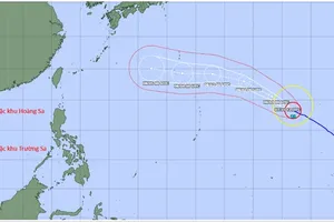
At sea, strong northeasterly winds have been recorded at Huyen Tran Station at level 6 (39-49 kilometers per hour) to 7 (50–61 kilometers per hour). At Con Dao Station, gusts have reached level 7.
Forecasts for the night of February 19 and daytime February 20 indicate that in the eastern part of the northern East Sea, winds will strengthen to level 6, with gusts of level 7 to level 8 (62–74 kilometers per hour), resulting in rough seas. From February 20 onward, winds are expected to gradually ease, though wave heights may range from 3 to 5 meters.
In the central East Sea, winds are forecast at level 5 (29–38 kilometers per hour), at times rising to force 6 with gusts of forces 7 to 8. Seas are expected to remain rough, with waves between 2.5 and 3.5 meters.
Waters stretching from Khanh Hoa to Ca Mau, as well as the western expanse of the southern East Sea, including the western waters of the Truong Sa (Spratly) Archipelago special zone, are experiencing northeasterly winds at level 6, at times rising to level 7 at night, with gusts of force level 8 to level 9 (75–88 kilometers per hour). Sea conditions are rough to very rough, with waves ranging from 2 to 4 meters.
Head of the Weather Forecasting Department at the National Center for Hydro-Meteorological Forecasting, Nguyen Van Huong, warned that on the night of February 20, the same maritime areas will continue to see strong northeasterly winds at level 6, gusting to levels 7–8, with wave heights of 2.5 to 3.5 meters and rough seas before conditions gradually ease.
The marine natural disaster risk level has been set at level 2. All vessels operating in the affected waters face a heightened risk from strong winds and high waves.
To proactively respond to strong winds at sea, the National Steering Committee for Civil Defense has advised coastal provinces and cities to closely monitor warnings, forecasts, and developments related to hazardous marine conditions.
Local authorities are urged to promptly inform captains, vessel owners, and operators currently at sea so they can take preventive measures and adjust production or fishing plans as necessary, ensuring the safety of both people and property. Maintaining reliable communication channels is also essential to enable a swift response to any adverse situations that may arise.