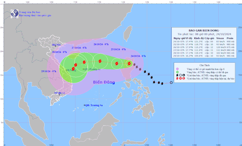
 Trami storm path forecast (Photo: the National Center for Meteorological and Hydrological Forecasting)
After that, the tropical storm will continue rapidly intensifying with its sustained winds ranging between 117 kilometers per hour and 183 kilometers per hour above.
According to the National Center for Meteorological and Hydrological Forecasting, at 7 a.m. on October 24, Trami storm was at around 17.4 degrees north latitude and 121.3 degrees east longitude on the land of northern Luzon Island, Philippines with maximum sustained winds of 75-88 kilometers per hour.
The storm primarily moved west-northwest at an hourly speed of at least 15 kilometers per hour.
It is forecast that the storm will churn in the East Sea at 7 a.m. on October 25.
In the next 48 hours, Trami will be located in the northern waters of the Paracel Islands, with winds near the storm’s center hitting 117-149 kilometers per hour.
The eastern waters of the northern East Sea will suffer from the impacts of huge waves, rough seas and storm-force winds.
All vessels operating in the above-warned dangerous areas are likely to face high risks of thunderstorms, cyclones, whirlwinds, and huge waves.


