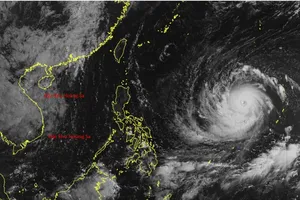
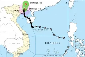
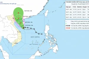
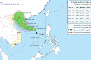
The National Center for Hydro-Meteorological Forecasting reported that on June 26, a tropical depression near eastern Hainan Island (China) is causing rough weather over the East Sea and across multiple inland regions of Northern, Central, Central Highlands and Southern Vietnam.
The system is moving northwest at about 20 kilometers per hour.

Under the impact of the tropical depression, throughout June 26, showers, thunderstorms and strong winds are forecast across the East Sea, including the Hoang Sa (Paracel) and Truong Sa (Spratly) Islands, the Gulf of Thailand and the coastal waters from Binh Thuan to Ca Mau and Kien Giang.
")
The National Steering Committee for Natural Disaster Prevention and Control has urged coastal localities, especially in the Northern and North-Central regions, to closely monitor the tropical depression, reinforce boats and aquaculture cages, and take proactive measures against heavy rain, flooding and landslides.
Prolonged heavy rain poses a high risk of flash floods and landslides on mountain slopes in the Northern provinces, especially Yen Bai, Lao Cai, Ha Giang, Son La and Lai Chau. Low-lying urban areas also face the risk of localized waterlogging.
The National Center for Hydro-Meteorological Forecasting (NMCF) warned of thunderstorms which may bring widespread cyclones, lightning, hail and strong gusts.