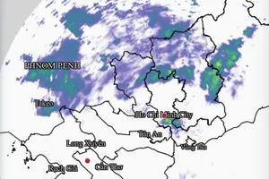
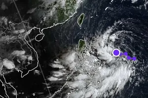
According to the National Center for Hydro-Meteorological Forecasting, the center of the tropical depression was located at approximately 16 degrees North latitude and 116.2 degrees East longitude, about 500 kilometers east-southeast of the Paracel Islands.

The depression is moving northwest at around 15 kilometers per hour, with maximum sustained winds of 39 kilometers to 49 kilometers per hour with higher gusts.
On the forecast track, the center of the system is expected to move across the northern portion of the East Sea including the Paracel Island at 15 kilometers to 20 kilometers per hour within the next 48 to 72 hours, and then it will downgrade gradually.
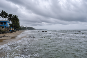
However, the affected areas still face significant weather risks.
In the northern portion of the East Sea, including the Paracel Islands, weather conditions will worsen with thunderstorms, higher gusts and rough seas. Wave heights may reach two to four meters, posing serious threats to vessels.
The National Center for Hydro-Meteorological Forecasting recommended all vessels closely monitor the tropical depression’s developments and take proactive safety measures.


)