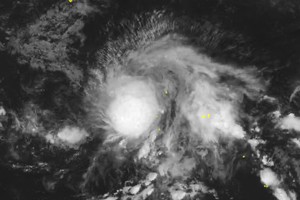
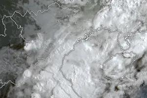
A representative from the National Center for Hydro-Meteorological Forecasting (NCHMF) reported that, after weakening into a tropical depression, the circulation of Storm No.4 continues to bring rainfall of 100-200 mm, with some areas receiving over 300 mm, extending through the end of September 20.
Mr. Vu Anh Tuan, Deputy Head of the Weather Forecasting Department at the NCHMF, stated that as of 4 p.m. on September 19, the center of Storm No.4 had moved inland into Quang Binh and Quang Tri provinces.

Previously, the storm was a level-9 typhoon with gusts reaching level 10 (89-102km/h) over Con Co Island in Quang Tri Province.
The expert also noted that from the morning to the afternoon of September 19, heavy rain had affected the region from Ha Tinh to Thua Thien Hue, with rainfall generally ranging from 100-200 mm and some areas recording over 200 mm.
From the evening to night of September 19, the tropical depression, which has weakened from Typhoon No.4, will continue moving westward into Central Laos and further weaken into a low-pressure area.
Mr. Vu Anh Tuan warned that heavy rain will persist in the region from Thanh Hoa to Quang Tri from the night of September 19 through September 20. Rainfall is expected to be between 100-200 mm, with some areas receiving over 300 mm.
Notably, after the storm weakens into a tropical depression, the North Central Coast will experience intense rainfall tonight, September 19. Rainfall could reach 150 mm within just six hours, increasing the risk of flash floods in mountainous areas of Ha Tinh, Quang Binh, and Quang Tri provinces and causing flooding in major cities.


