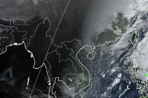
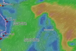
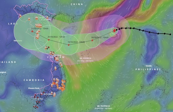
 The forecasted direction and location of Storm Nesat.
According to the National Center for Hydro-meteorological Forecasting, at 4 p.m. on October 17, the center of Storm Nesat was at about 19.3 degrees North latitude and 115.9 degrees East longitude, about 500km Northeast of Hoang Sa Archipelago. The strongest wind in the area near the center of the storm was at level 12 (118-133km/h), with gusts of level 14. The storm was moving in the west-southwest direction at a speed of about 15km/h.
It is forecast that in the next 24 to 48 hours, by 4 p.m. on October 18, the center of Storm Nesat will be located at 18.1 degrees North latitude and 112.8 degrees East longitude, about 180km north-northeast of the Hoang Sa Archipelago. The storm moves west-southwest at a speed of 15 km/h, with the strongest winds at levels 12-13 and gusts at level 15 and possibly will strengthen.
By 4 p.m. on October 19, the storm's center will be at 17.6 degrees North latitude and 109.5 degrees East longitude, about 340km east-southeast of the mainland of provinces from Ha Tinh to Thua Thien-Hue. The storm continues to move west-southwest at a speed of 15 km/h, with the strongest winds at levels 9-10 and gusts at level 12, and is likely to weaken.
The affected areas include the Northern region of the East Sea, the Southern region of the Gulf of Tonkin, and the waters from Quang Tri to Quang Nam provinces.
In the next 48 to 72 hours, the storm will move mainly in the west-northwest direction at a speed of 10-15km per hour, then gradually weaken into a tropical depression, with the strongest wind at level 7 and gusts at level 9.
In the next 72 to 96 hours, the tropical depression will mainly move west-northwest at 10km per hour and gradually weaken into a low-pressure area.
It is forecasted that on the night of October 18 and 19, in the Gulf of Tonkin, the sea from Quang Tri to Quang Ngai provinces, there will be strong winds at level 6-7, gusts at level 8-9, and rough seas with high waves from 3m to 5m. The Northern area of the East Sea, including the waters of the Hoang Sa Archipelago, will experience strong winds at levels 9-10. The strongest wind in the area near the center of the storm will be at level 11-13, with gusts of level 15, and sea waves of 6-8m high, with those in the area near the storm center at 8-10m. The sea will be extremely rough. The area in the middle of the East Sea will have level-5 north-westerly winds, sometimes level 6, and gusts at level 7-8, rough sea, and waves from 3m to 5m high.
The disaster risk warning level due to strong wind at sea is at level 3. All vessels and other activities in these sea areas are at high risk of being affected by strong winds and large waves.


