")
The statement was made by the Ho Chi Minh City Department of Agriculture and Environment at a press conference on November 13.
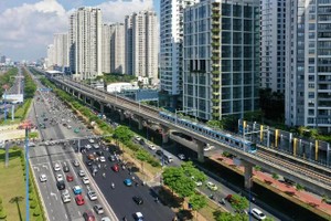
Multiple factors contribute to land subsidence, including weak geological conditions and heavy vehicular traffic. Rapid urbanization, excessive groundwater extraction beyond permissible limits, and widespread concretization, which reduces the natural replenishment of groundwater from rainfall, have further lowered groundwater levels, resulting in ground settlement.
In a proactive effort to mitigate the risks of land subsidence, the city has taken early action. In 2010, it launched the “Ground Deformation Monitoring Project in Ho Chi Minh City Using Differential INSAR Technology,” which utilized SPOT-5 optical satellite imagery and RADAR satellite data for detailed analysis.
As a result of the project, the city successfully developed a land subsidence zoning map for Ho Chi Minh City and established two long-term ground monitoring stations.
")
By the end of 2019, the city continued to experience surface subsidence, with the most severely affected area recording a measured settlement of 31 millimeters.
In addition, a recent survey conducted by the Japan International Cooperation Agency (JICA) indicates that land subsidence in Ho Chi Minh City has been ongoing continuously since 1990, with cumulative settlement estimated at approximately one meter to date. Current subsidence rates are estimated at around 2 to 5 centimeters per year.
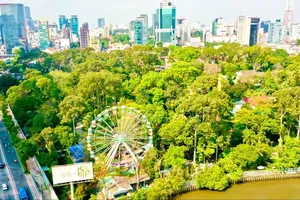
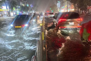
In commercial hubs, subsidence rates reach approximately 7 to 8 centimeters per year, about twice the rate of sea-level rise, which stands at roughly 1 centimeter annually. The combination of land subsidence, tidal flooding, and rising sea levels increasingly places Ho Chi Minh City at risk of “sinking,” posing a direct threat to the city’s long-term development amid efforts to adapt to climate change.
A representative from the Ho Chi Minh City Department of Agriculture and Environment stated that the Department of Science and Technology is also implementing the task “Simulation and Forecasting of Ground Deformation in Ho Chi Minh City,” alongside the “Technical Assistance Project to Promote Solutions for Land Subsidence in Ho Chi Minh City.” Once completed, these initiatives are expected to provide a comprehensive assessment and identify the primary causes of subsidence in the city, forming the basis for an integrated strategy to mitigate ground settlement.
At present, to monitor, assess, and mitigate land subsidence, the city is implementing several measures. These include continuing ground deformation monitoring at two stations located in Tan Tao Industrial Park and Binh Hung Commune using differential INSAR technology. In addition, efforts are being made to reduce groundwater extraction across the city.
")
The city has issued a list and zoning map restricting groundwater extraction, providing a crucial legal framework for evaluating and granting permits for groundwater use in a manner that effectively addresses land subsidence in the coming years.
To respond effectively to subsidence, the city needs to establish a regular monitoring and forecasting system for ground settlement, leveraging modern technologies to support authorities in making informed decisions that align with natural conditions and sustainable development goals.
The Ministry of Agriculture and Environment is implementing the “National Height System Modernization” project, aimed at establishing a stable, long-term high-speed system to determine the average sea level. The project, running from 2022 to 2025, involves the construction of four century-height benchmarks at Vietnam National University - Ho Chi Minh City, the People’s Committee of Nhuan Duc Commune, Lang Le–Bau Co Cultural Park, and the Children’s House in Can Gio Commune, along with two boundary benchmarks in Dong Nai and Long An provinces. Leveling measurements were completed in 2023, with subsequent monitoring cycles scheduled for 2024 and 2025, after which the data will be handed over to local authorities for utilization.