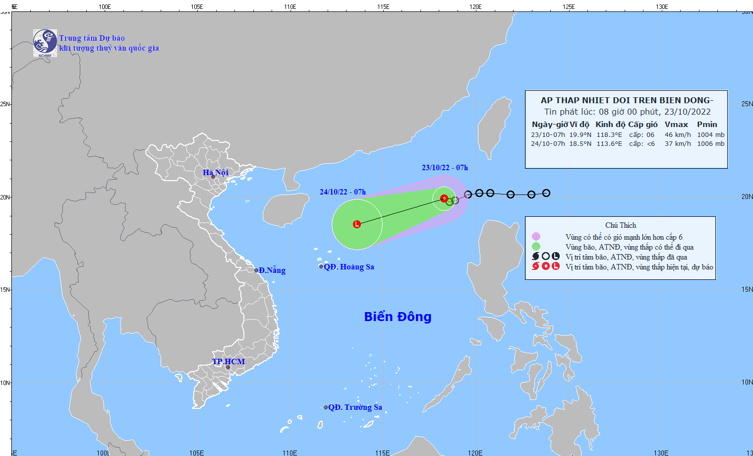
The newly-formed tropical depression enters East Sea (Photo: NCHMF)
The meteorologists predicted that the eye of the tropical depression would be likely to locate around 460 kilometers north-northeast far from the Paracel Islands by Sunday afternoon.
In the next 48-72 hours, the path of the system is expected to turn west-southwest with a maximum speed of 15 kilometers an hour, after that it will tend to downgrade gradually.
On the same day, the weather agency also informed that in the period of October 26-30, the water level at the Vung Tau monitoring station will continue rising fast before peaking at 4.3 meters between 1- 3 a.m. and 2-4 p.m. on October 26 and 27.
Under the impact of the tidal wave, the southeastern coastal areas are warned to brace for flooding in low-lying areas and localities along rivers.


)


