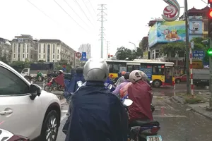
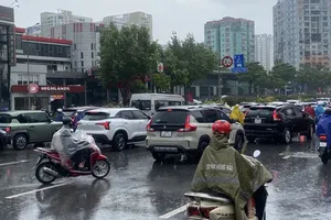
From the night of June 20 to the morning of June 21, the Northern mountainous region experienced a widespread heavy rain event, lasting many hours with very high intensity.

")
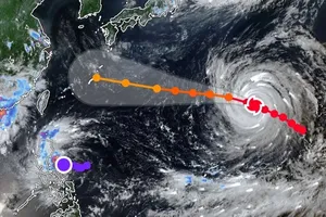
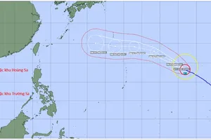
Weather radar data from automatic rainfall measurement apps updated at 6 a.m. on June 21 showed a cumulonimbus cloud triggering widespread moderate to very heavy rains from Southern Japan to Northern Vietnam, including provinces and cities of Ha Giang, Cao Bang, Hanoi, Thanh Hoa and others.
According to the Vrain automatic rainfall monitoring system, deployed by the Vietnam National Center for Hydro-Meteorological Forecasting, as of 6 a.m. on June 21, several localities had recorded rainfall exceeding 150mm. Among them, Thai Nguyen reported 253mm of rainfall at Binh Son Station.
")
In contrast, the Central region remained mostly dry. Provinces from Nghe An to Hue have experienced scattered rain or without rain, while both the Southern region and the Central Highlands have seen scattered showers.
The National Center for Hydro-Meteorological Forecasting has issued a warning that this intense rain event may linger until June 22, primarily affecting the Northern mountainous and midland areas, along with dangerous phenomena such as flash floods, landslides in mountainous areas, and localized flooding in low-lying areas.

In the delta region, water levels in downstream Red River and Thai Binh River system are changing slowly. From now until June 22, flood water levels in upstream Thao River and Lo River system, and small rivers in the Northern region can rise to about two to four meters.
At that time, rainfall in some mountainous and midland areas may exceed 300mm.
Since the afternoon of June 20, the Meteorological and Hydrological Administration under the Ministry of Agriculture and Environment has released an assessment report on this rain event.
Deputy Minister of Agriculture and Environment Nguyen Hoang Hiep issued an official dispatch to the People's Committees of Northern mountainous provinces, urging them to take proactive measures in response.
Local authorities are required to ensure traffic safety, arrange personnel for monitoring and guidance at flooded crossings and fast-flowing water sites, and prohibit people and vehicles from passing through unsafe places.
In addition, they must inspect and reinforce infrastructure such as reservoirs and mining sites, and prepare rescue teams and equipment for emergency response.
The Department of Dyke Management and Disaster Prevention will provide updates and coordinate appropriate responses in the coming days.