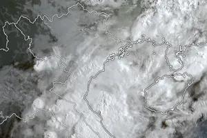
It is predicted to move the northwestward at a speed of 10 kilometers an hour, and is expected to operate powerfully in the eastward of Bengan Bay.
Because of its circulation, the southern territorial waters from Ca Mau to Kien Giang and the Gulf of Thailand continue suffering showery weather, thunderstorm, strong wind of level 6-8 and big wave of 2-3 meters.
According to Vice Director of the National Hydrology Meteorology Forecast Center Le Thanh Hai, appearance of the tropical depression in the Gulf of Thailand is an unusual phenomenon which comes once in every five years.
Meanwhile, the Gulf of Tonkin and territorial waters from Quang Tri to Quang Nam including the Ly Son Island see powerful wind of level 6-8, big wave of 2-3 meters and sea rough due to an impact of the ongoing cold front.
Medium- heavy rains are predicted in provinces from Nghe An to Quang Nam by November 8.
 From November 9, rainfall in the central region is expected to reduce slightly.


