According to the National Center for Hydro-Meteorological Forecasting, Hanoi and the Northern region are seeing scattered showers and thunderstorms under the influence of a cold air mass on April 28. Daytime highs in Hanoi are forecast at around 29–30 degrees Celsius.
The Northwestern region had already recorded scattered showers and thunderstorms on the night of April 27. By the morning of April 28, light rain continued across the North, Thanh Hoa, and Nghe An, with rainfall generally ranging from 10–20mm, and over 30mm in some areas.
The cold air mass is currently moving southward. By the night of April 28, it is expected to affect the Northeastern region before expanding to the North Central Coast and parts of the northwest, then further into the Central Coastal region. Winds will shift to the northeast at level 2–3, strengthening to level 3–4 in coastal areas.
From the evening of April 28 to the morning of April 29, the North will experience rain, with moderate rainfall in some areas and localized heavy to torrential downpours. On April 29, the North Central Coast will see scattered showers and thunderstorms, with heavy rain in places. The lowest temperatures during this cold spell are expected to range from 20–23 degrees Celsius in the North, dropping below 20 degrees in mountainous areas, and 21–24 degrees in the North Central Coast.
Meteorological authorities say these conditions will keep Hanoi and Northern provinces relatively cool with intermittent rain throughout the April 30 and May 1 holiday.
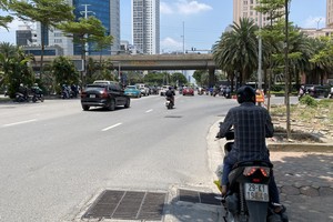
In contrast, Southern Vietnam will continue to endure heat in the coming days, as it remains unaffected by the cold air mass. The agency noted that the heatwave in the South is likely to gradually ease from early May, as the equatorial trough strengthens, bringing increased evening and nighttime thunderstorms.