The southern metropolis is the most strategic maritime gateway to the southern economy, with a rare concentration of competitive advantages.
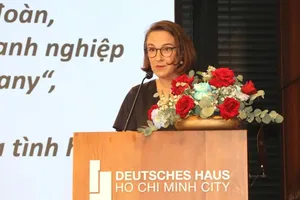
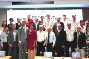
According to Mr. Nguyen Do Dung, CEO of enCity International Consulting Company, to move further, Ho Chi Minh City needs a new approach: building an integrated operating system for its marine economy.
Ho Chi Minh City has outstanding advantages
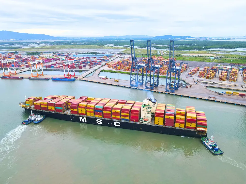
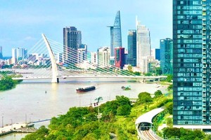
Ho Chi Minh City was formed and developed as a port city. From an early period, Can Gio, Ganh Rai Bay, the Saigon River, the Dong Nai River, Ben Nghe, and Cho Lon served as meeting points for flows of goods, people, and capital. Goods from the Mekong Delta, the Southeastern region, and Cambodia converged on Ho Chi Minh City via rivers, canals, and maritime routes before being shipped to markets around the world.
The city has long held an advantage by being strategically positioned where these flows converge. Today, those flows encompass not only rice, agricultural products, and traditional commodities, but also industrial goods, components, energy, logistics data, investment capital, insurance, green credit, and maritime services. Ho Chi Minh City’s drive toward the sea is therefore a return to its historical instinct, but at a new level: that of a megacity with a maritime economy.
Singapore’s experience shows that Ho Chi Minh City should not set its sights merely on becoming a city with a major port. Instead, it should aspire to become a regional maritime services hub, supported by a comprehensive port ecosystem encompassing finance, insurance, law, arbitration, ship management, technology, clean fuels, and data.
Following the merger, Ho Chi Minh City has an exceptionally rare combination of assets, consisting of a financial center, a large consumer market, an industrial base in what was formerly Binh Duong, Long Thanh Airport at the eastern gateway, and connectivity with Dong Nai, Tay Ninh, and the Mekong Delta. It also has an expanded seaport system stretching from Cat Lai, Hiep Phuoc, and Nha Be to the port cluster in Binh Duong and Ba Ria–Vung Tau, particularly Cai Mep–Thi Vai.
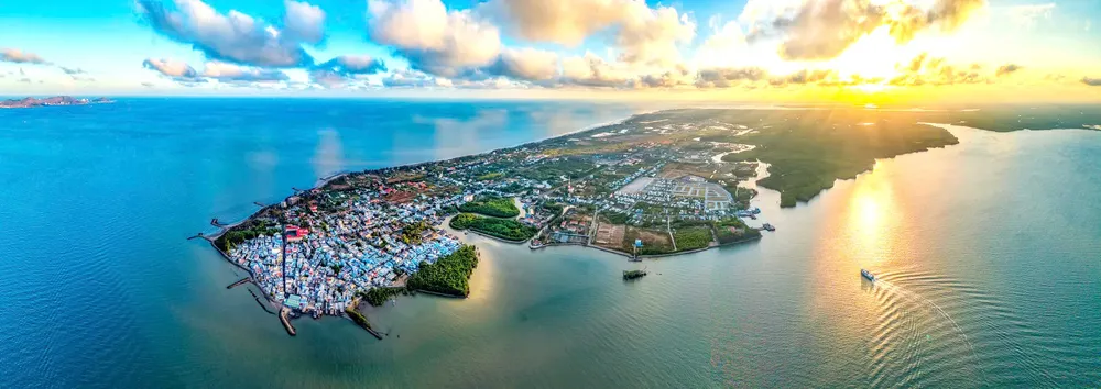
For the first time, Ho Chi Minh City can view the entire Can Gio–Ganh Rai–Cai Mep–Thi Vai–Phu My–Long Son–Vung Tau–Binh Chau–Con Dao area as a single integrated entity. Previously, each locality occupied a different shore of the same bay and pursued its own development objectives. Now, Ho Chi Minh City can ask a broader question: How can this bay be transformed into a strategic bay for Vietnam?
Ganh Rai should not be viewed simply as a body of water lying between various projects. It is a strategic economic space where seaports, logistics, energy, industry, finance, tourism, ecology, and national defense converge. Viewed on a broader scale, Ganh Rai Bay encompasses approximately 1,000 square kilometers of water. Alongside it are more than 75,000 hectares of mangrove forests in Can Gio. This means the area has both the potential for seaport and industrial development and an exceptionally rare ecological foundation—something few coastal cities in the region possess.
However, one point requires particularly close attention: the sheltered waters inside the bay, namely the enclosed bay area extending inward from the Can Gio–Vung Tau connecting route, cover only about 200 square kilometers. This is a very limited space compared with the maritime development ambitions being planned for the area. In other words, Ganh Rai is a large bay when viewed as an urban, ecological, and economic structure. But it is a constrained space when viewed from the perspective of developing a comprehensive maritime ecosystem.
Against this backdrop, Ho Chi Minh City’s marine economy in the new period should be organized around six pillars, including international seaports and logistics; free trade zones and post-port services; marine industry and clean energy; high-value maritime services; coastal tourism and marine urban development; and marine ecology and the Can Gio mangrove forest. Among these, Can Gio should serve as a laboratory for a green maritime city, where a transshipment port, an ecological urban area, environmental technologies, clean transport, and mangrove conservation are brought together under a common development discipline.
The breakthrough lies in an overarching strategy for the Can Gio–Ganh Rai bay area, in which land, waterways, shipping channels, ports, logistics, energy, ecology, tourism, and urban development are organized as a single system—an operating system for the marine economy.

Three priorities for Can Gio–Ganh Rai
1. Plan territorial waters as a form of territory
The enclosed waters of Ganh Rai cover only about 200 square kilometers but are expected to accommodate a wide range of functions. Therefore, the water surface, seabed, shipping channels, anchorage areas, energy zones, and conservation areas must be planned with the same level of detail and strategic consideration as land areas.
2. Protect Ganh Rai’s long-term maritime capacity
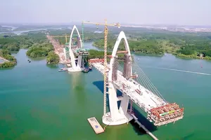
All projects crossing the bay, including the Can Gio–Vung Tau sea-crossing route, must be assessed against projections for vessel traffic, cargo flows, turning basins, and maritime demand over the next 50–100 years. The Ganh Rai shipping channel is a national asset; short-term decisions must not be allowed to constrain its long-term expansion capacity.
3. Build a digital twin of the Can Gio–Ganh Rai area
The city needs an integrated digital data platform covering shipping channels, nautical charts, tides, water quality, mangrove forests, ports, warehouses, energy facilities, rescue operations, oil spills, and customs data. A strategic maritime area cannot be managed through static maps and paper-based reports alone.
Ho Chi Minh City eyes leading maritime hub in Asia

Becoming a strong maritime center, generating prosperity from the sea, and achieving sustainable development based on marine resources, while emerging as one of Asia’s leading international logistics and maritime hubs by 2045, is the vision Ho Chi Minh City has set out in its plan to implement Resolution No. 20-NQ/TW.
By 2030, the city aims to establish a solid foundation for becoming a modern, green, and smart marine economic center with international competitiveness. Specific targets include an average annual growth rate of 14 percent in marine and island tourism, average annual growth of 8 percent in the output value of marine aquaculture, and completing 100 percent of coastal roads within the city.
Under the plan, the city will focus on completing institutions, policies, and marine spatial planning; promoting mechanisms for free trade zones, integrated logistics, and open ports; and expanding decentralization and delegation of authority to attract investment. Resources will be mobilized through a model led by public investment, combined with public-private partnerships, green finance, and strategic investors.
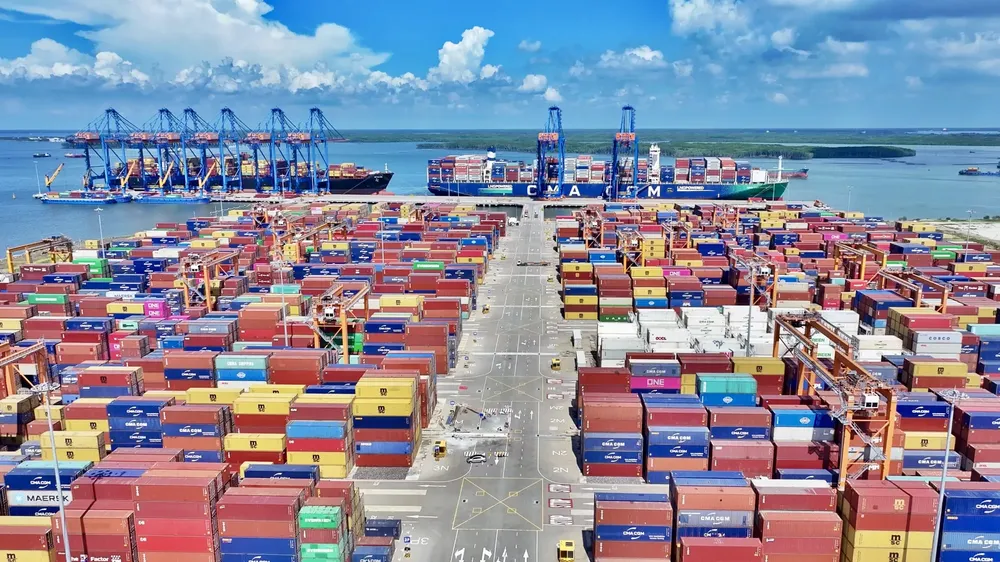
The seaport infrastructure system will be integrated into a network connecting roads, waterways, railways, and logistics centers. Cai Mep–Thi Vai–Can Gio will be developed toward becoming a green and smart port complex, while the city will expand high-value services such as insurance, maritime finance, and supply chain management, linked to an international financial center.
Science, technology, and human resources will serve as cross-cutting solutions, including the development of shared databases and digital maps of marine and coastal areas; the application of artificial intelligence, big data, and monitoring technologies; and stronger links among businesses, research institutes, and universities.
The city also calls for the restoration of the Can Gio mangrove forest and Con Dao ecosystems, tighter control of waste discharges, and measures to combat illegal, unreported, and unregulated (IUU) fishing. The role of residents and businesses as key stakeholders will be linked to improving livelihoods, protecting the environment, and safeguarding national sovereignty over the sea and islands.
Urban Development Law helps unlock institutional bottlenecks
The biggest bottleneck to the development of Ho Chi Minh City’s marine economy lies in the fragmented nature of its port system, post-port areas, and water spaces. The city has deep-water ports, river ports, industrial zones, energy facilities, logistics hubs, and port cities, but many of these components are still operating according to separate logics. Ports, land, shipping channels, customs, national defense, energy, the environment, roads, waterways, and railways are managed by different levels and agencies.
This is not necessarily problematic from an administrative perspective, but without a sufficiently strong coordination mechanism, Ganh Rai Bay could become fragmented along sectoral, project, and jurisdictional lines. In that case, the risk would not lie in any individual project, but in the overall picture: each project could be reasonable on its own, yet collectively they could weaken the strategic capacity of the entire bay.
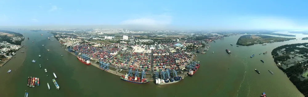
One particularly notable figure is that the Cai Mep–Thi Vai area alone has around 35 port terminals, more than 20 of which are already operational. This highlights the area’s substantial port capacity. But to become truly competitive, the ports need to have clearly defined roles, be interconnected, coordinate cargo flows, share logistics infrastructure, and be linked to high-value services.
The latest study on Ho Chi Minh City’s marine space shows that the challenges are even greater. Container throughput planned for 2030 could reach around 38 million TEUs a year, twice the current level, including approximately 33 million TEUs from the region’s gateway port cluster and 5 million TEUs from the transshipment port. The inland logistics system would have to handle an additional 71–90 percent of cargo volumes, while the capacity of existing hinterland connections is already showing signs of overload.
The scale of cargo planned for the Can Gio–Cai Mep–Thi Vai area is approaching that of major maritime hubs in the region. Unlike Singapore, however, where the entire port–urban–services–governance ecosystem is organized as an integrated system, Ho Chi Minh City is seeking to manage this ambitious scale of development within a core enclosed water area of only about 200 square kilometers, which is also ecologically sensitive and subject to numerous overlapping functions.
The Urban Development Law opens up an important opportunity by providing a framework for more specialized development models, including special urban areas, special economic zones, reclaimed urban areas, transit-oriented development, mechanisms to capture increases in land value, decentralization and delegation of authority, and pilot mechanisms.
However, the law does not automatically generate growth; it merely opens the door. Ho Chi Minh City can step through that door with a coherent development plan. The city should develop a proposal for a Can Gio–Ganh Rai–Cai Mep Special Marine Economic Corridor.
This would not simply be a fenced-off land area or a tax-incentive zone. Rather, it would be a new governance institution for an integrated maritime, land-based, and port-hinterland space.
If properly designed, a special marine economic zone would enable the city to do three things: safeguard long-term priorities for maritime development; assign distinct roles to different areas within the bay; and manage the entire space through data.
Five strategic solutions
Five recommendations to realize the significance of the Urban Development Law and the new policies aimed at building a strong maritime nation:
1. Develop a marine spatial plan for Can Gio–Ganh Rai–Cai Mep–Vung Tau–Binh Chau
Water spaces need to be functionally zoned, including shipping channels, anchorage areas, turning basins, reserve areas for future generations of large vessels, energy cables and pipelines, conservation zones, marine tourism areas, and national defense and rescue zones, among others. Vietnam could draw on the Netherlands’ approach of dividing territorial waters into multiple functional zones, rather than treating the sea as empty space between projects on land.
2. Reorganize the cargo network across the Southeastern region and the Mekong Delta
Cargo from Dong Nai, Tay Ninh, and the Mekong Delta needs to be transported to Cai Mep–Can Gio through ring roads, waterways, freight railways, transshipment hubs, and logistics centers.
3. Assign distinct roles to the port system
Cai Mep–Thi Vai should serve as a deep-water port and international logistics hub, with policies to connect individual terminals into an integrated system to optimize capacity. Can Gio should become an international transshipment port, but under strict ecological controls. Hiep Phuoc and river ports should serve urban logistics, inland waterway transport, and cargo transfer. Vung Tau should develop maritime technical services, offshore energy, training, and maritime safety. Thu Thiem should focus on high-value activities such as maritime finance, insurance, law, logistics data, and green capital.
4. Build a high-value maritime services cluster
Focusing only on terminals and cargo yards means competing on cost. Developing maritime services means competing on value. Ho Chi Minh City’s new goal should therefore not be simply to increase cargo throughput but to increase the value retained from each maritime transaction through finance, insurance, law, arbitration, data, port technology, supply chain management, and maritime technical services.
5. Establish a coordination mechanism for the bay and its port hinterland
Ports need cargo from the region, while the region needs ports to reach global markets. Therefore, there should be a coordination mechanism involving Ho Chi Minh City, central ministries and agencies, port operators, customs, national defense, energy companies, and localities across the southern key economic region.
This mechanism should answer the question, "Who will organize the ecosystem around the port?” Ho Chi Minh City could take the lead in spatial planning, land, connectivity infrastructure, the investment environment, data, and urban development. The central government would retain responsibility for shipping channels, seaports, customs, national defense, and strategic infrastructure. Port, logistics, and energy companies, along with strategic investors, would participate in operations, investment, and technological innovation.

)