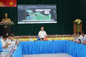
The Ho Chi Minh City Department of Planning and Architecture has launched a pilot version of the electronic information portal for publishing and publicizing urban and rural planning data on a Geographic Information System (GIS) platform.
The system enables users to view multiple planning data layers on GIS maps at different levels, including project boundaries and land-use functions. It also allows users to download approved planning decisions and related documents.
Users can search for planning information using map sheet numbers, land plot numbers, administrative units before and after restructuring, land boundary coordinates, house addresses and street names.
According to the department, the portal also integrates a “Feedback on Functions and Data” feature, allowing users to report inconsistencies, unsynchronized information, or technical issues related to planning data, GIS data and displayed information. The feedback mechanism helps authorities promptly inspect, review and address problems.
For agencies and organizations granted access accounts, including ward, commune and special-zone authorities as well as management boards of industrial parks, export processing zones and high-tech parks, the system provides functions to report difficulties and issues in planning management for coordination and resolution by the municipal Department of Planning and Architecture.
A large amount of planning data has already been uploaded to the system. This includes land-use planning data across various urban planning levels such as provincial planning, general urban planning, zoning plans, and detailed planning schemes.
")
The portal also contains land-use and technical infrastructure planning data under Ho Chi Minh City’s adjusted master plan through 2040, with a vision to 2060, approved by the Prime Minister under Decision No. 1125/QD-TTg.
In the coming period, the city’s planning sector will continue developing mobile versions for Android and iOS devices, adding topographic data layers, updating and standardizing raster and vector planning data, and enhancing administrative and analytical functions.
The goal is to build a unified GIS platform serving urban and rural planning management while ensuring connectivity and data sharing with the national information and database system for construction activities in accordance with regulations from the Ministry of Construction.