Sunny skies are expected to prevail across Ho Chi Minh City and the Southern region on the morning of October 27, with scattered showers and thunderstorms forecasted for late afternoon and evening, according to the National Center for Hydro-Meteorological Forecasting.
Temperatures in Ho Chi Minh City will range between 25 and 27 degrees Celsius at night, reaching highs of 32 to 34 degrees Celsius during the day.
Starting October 28, rainfall is expected to increase, covering approximately half of the Southern region.
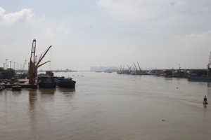
Meanwhile, the Southern Hydrometeorological Station issued a renewed warning regarding tidal flooding risks in low-lying areas of Ho Chi Minh City this afternoon as water levels on the Saigon River continue to rise. Peak tides at Phu An, Nha Be, and Thu Dau Mot stations are all projected to exceed warning level 3 (1.6 meters).
Water levels at Phu An and Nha Be stations are forecast to reach 1.7 to 1.75 meters, exceeding warning level 3 by 0.10 to 0.15 meters. Meanwhile, water levels at Thu Dau Mot station could reach 1.8 to 1.86 meters, topping Warning Level 3 by 0.20 to 0.26 meters. Peak tides are expected during two daily windows—from 5:00 a.m. to 7:00 a.m. and 5:00 p.m. to 7:00 p.m. These times coincide with peak commute hours, posing significant travel disruptions for residents in low-lying areas. Peak water levels will begin to ease on October 28, though they are expected to remain above warning level 3.
In Urgent Official Dispatch No. 36556/SNNMT-CCTL, the Ho Chi Minh City Department of Agriculture and Environment requested ward and commune People's Committees to regularly broadcast updates on the late-October high tides so residents can take proactive measures. Local authorities were also instructed to inspect dykes, embankments, revetments, sluice gates, and tidal control valves, while preparing materials for immediate reinforcement under the "four on-the-spot" principle. The department emphasized preventing dyke overflows and tidal gate failures that could flood residential areas and disrupt livelihoods.
Additionally, the Department of Agriculture and Environment requested the Department of Construction, the Ho Chi Minh City Irrigation Service Exploitation Management Company Limited, and the Technical Infrastructure and Traffic Management Center to coordinate with local authorities. They are tasked with preparing personnel, vehicles, and equipment to address vulnerable infrastructure and efficiently operate discharge gates, tidal control sluices, and pumping stations. For flooded roadways, authorities were urged to implement safety measures to prevent accidents.

The Southern Hydrometeorological Station predicted that southern Vietnam would experience scattered rain beginning on October 27. In Lam Dong, Dong Nai, Ca Mau, and Can Tho City, rainfall is expected to cover roughly half of their areas. By October 28, as high-altitude atmospheric disturbances intensify, rainfall will spread across the entire Southern region, with localized moderate-to-heavy rain.
The National Center for Hydro-Meteorological Forecasting also warned on the morning of October 27 that moderate to heavy rain—with localized torrents—will impact the region from Ha Tinh to Da Nang City from late afternoon October 27 through the night of October 29. Total rainfall is now expected to reach 70 to 150 millimeters, with localized totals topping 300 millimeters (up from an earlier forecast of 250 millimeters).
Between late afternoon October 27 and the night of October 28, rainfall across the Ha Tinh to Da Nang belt will average 50 to 100 millimeters, with localized spots exceeding 200 millimeters. Weather authorities warned of high-intensity downpours that could bring over 100 millimeters of rain within a three-hour window.
Rainfall will persist through October 29 with moderate to heavy rain and thunderstorms, though intensity is expected to ease compared to previous days, yielding 20 to 50 millimeters, with localized totals over 100 millimeters.
Overnight October 26 into early morning October 27, scattered showers and localized heavy downpours had already hit areas from Ha Tinh to Da Nang City, as well as the eastern parts of provinces from Quang Ngai to Dak Lak. Recorded rainfall included 53.4 millimeters at Phuc Trach Station in Quang Tri and 39.1 millimeters at De Gi Station in Gia Lai.
In Hanoi, conditions today are cloudy with daytime sunshine and no rain at night. Temperatures will range from a low of 23 to 25 degrees Celsius to a high of 30 to 32 degrees Celsius. Northeastern winds of level 2 to 3 are expected in the afternoon, bringing cooler, milder weather after a prolonged hot spell.