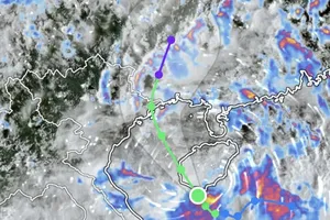
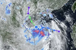
") |
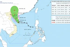
The direction of storm Doksuri. (Photo: NCHMF) |
At 7am on July 25, the storm was 230km east of Luzon island of the Philippines, with winds close to the storm’s eye at 167-183km per hour.
The storm is set to move northwest at a speed of 10-15km per hour in the next 48-72 hours, and will keep moving in the same direction at a speed of 15km per hour in the next 72-96 hours with its strength gradually weakening.
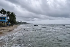
Due to the impacts of the storm, the northern area of the East Sea is predicted to experience strong winds and rough seas with waves of 5-7m from July 25-26.
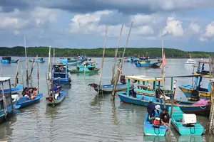
Showers and thunderstorms are likely to take place in the central and southern part of the East Sea, including the waters of Truong Sa as well as the area from Binh Thuan to Ca Mau, Ca Mau to Kien Giang, and the Gulf of Thailand.
The Central Highlands and the Southern region are forecast to experience moderate to heavy rain and thunderstorms, with an average rainfall of 40-100mm, even over 150mm in some places.
In the afternoon and evening of July 25, the areas from Thua Thien-Hue to Binh Thuan are likely to endure showers and thunderstorms, with rainfall of 20-40mm, even up to 70mm in some places.
On July 25, the highest temperature can rise to 34°C - 37°C in the Northern region and in the provinces of Thanh Hoa to Thua Thien-Hue in the Central region, even more than 37°C in some places.