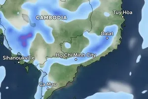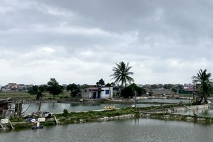
In the next 24- 48 hours, the zone would be able to turn into a tropical depression which is forecast to intensify into a storm to make landfall in the South- Central and Southern regions.
From the daytime of Saturday, the middle and the southern part of the East Sea including the Spratly Islands have experienced showers, thunderstorms and maximum winds of level 6-7; meanwhile, the northern part of the East Sea including the Paracel Islands is expected to suffer huge waves of 2-3 meters, rough sea and thunderstorm.
According to Vice Director of the National Hydrology Meteorology Forecast Center, the low- pressure zone was formed at a range of tropical convergence with gradual stronger operation.
In the next couple days, the low- pressure zone is forecast to become a tropical depression and new storm respectively which would be able to move the westward and make landfall in the Central region in the following days.






)


