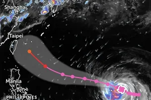
at 4:40 p.m. on July 5, based on satellite cloud observations from the Z.E application")
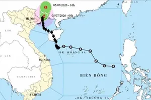
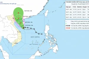
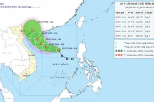
According to the National Center for Hydro-Meteorological Forecasting, at 1:00 p.m. on July 5, the center of the tropical depression was located at approximately 22.9 degrees North latitude and 108.3 degrees East longitude, over Guangxi Province, China. Maximum sustained winds near the center reached level 7 (50–61 km/h), with gusts up to level 9 (75–88 km/h). The tropical depression was moving north-northeast at a speed of around 10 km/h.
On the afternoon of July 5, Vietnam's meteorological authority forecast that the tropical depression would continue to weaken into a low-pressure area before gradually dissipating and would no longer pose a direct threat to Vietnam.
")
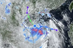
Although the storm has weakened, the meteorological authority warned that during the night of July 5 and throughout July 6, the northern Gulf of Tonkin is expected to experience strong southwesterly winds of level 6 (39–49 km/h), with gusts reaching level 7 (50–61 km/h) to level 8 (62–74 km/h). Sea conditions will remain rough, with waves measuring 2–3 meters.
During the night of July 6 and throughout July 7, the northern Gulf of Tonkin is forecast to continue experiencing southwesterly to southerly winds at level 5 (29–38 km/h), occasionally strengthening to level 6, with gusts of levels 7–8. Waves are expected to remain 2–3 meters high, and rough sea conditions will persist. Vessels operating in the area may still encounter hazardous conditions.