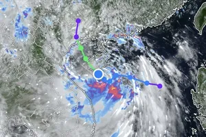
Director Mai Van Khiem of the National Center for Hydro-Meteorological Forecasting said on the afternoon of July 4 that tropical storm Maysak, the first storm this year, was approaching the northern part of Quang Ninh Province. Very heavy rain is expected across northeastern Vietnam from Friday night through the morning of July 5.
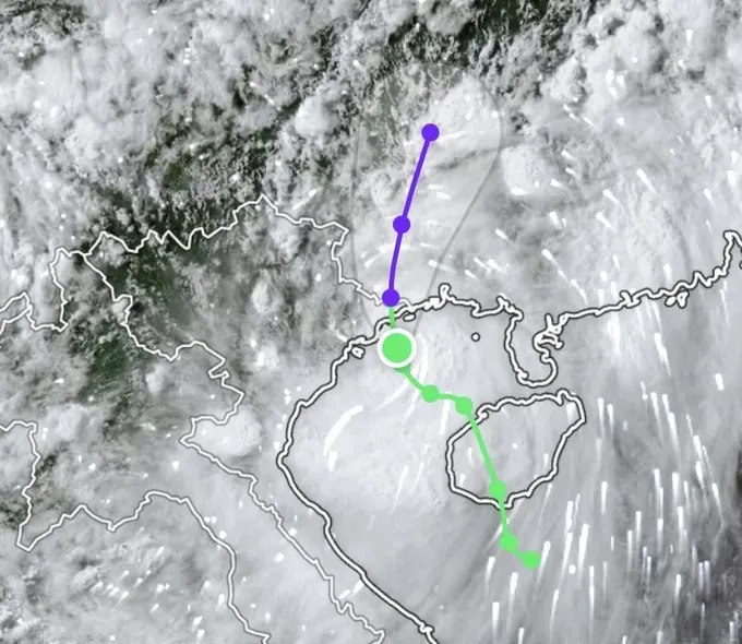
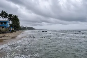
According to the National Center for Hydro-Meteorological Forecasting, the storm continued moving toward the Quang Ninh coast on Friday afternoon. The weather agency warned that from the afternoon until about 11 p.m. on July 4, coastal areas of Quang Ninh, Hai Phong and Hung Yen would be directly affected by the storm's circulation. Northeastern Vietnam is expected to experience very heavy rain through July 5, raising the risk of flash floods, landslides and flooding.

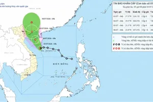
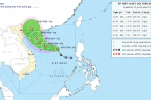
At 2 p.m. on July 4, the storm's center was about 90 km southeast of Mong Cai, Quang Ninh Province.
Under the storm's influence, Bach Long Vi Special Zone recorded sustained winds of Force 9 with gusts of Force 10. Co To Special Zone experienced Force 8 winds with gusts of Force 9 and waves reaching 2.25 meters, while Cua Ong in Quang Ninh recorded Force 8 winds with gusts of Force 9.
Forecasters said the strongest winds are expected between 3 p.m. and 9 p.m. on July 4, when the storm's center is forecast to move inland over Quang Ninh Province. Coastal areas are expected to experience Force 6-7 winds, increasing to Force 8 near the storm's center, with gusts of Force 9-10.

From the afternoon and night of July 4 through the end of July 5, northeastern Vietnam is forecast to receive 150-250 mm of rain, with isolated areas exceeding 450 mm.

Mountainous and midland areas in the Northern region face a high risk of flash floods, landslides and flooding over the next one to two days.
The National Center for Hydro-Meteorological Forecasting urged local authorities and residents to closely monitor the storm's development and strictly follow official evacuation and safety instructions.