 |
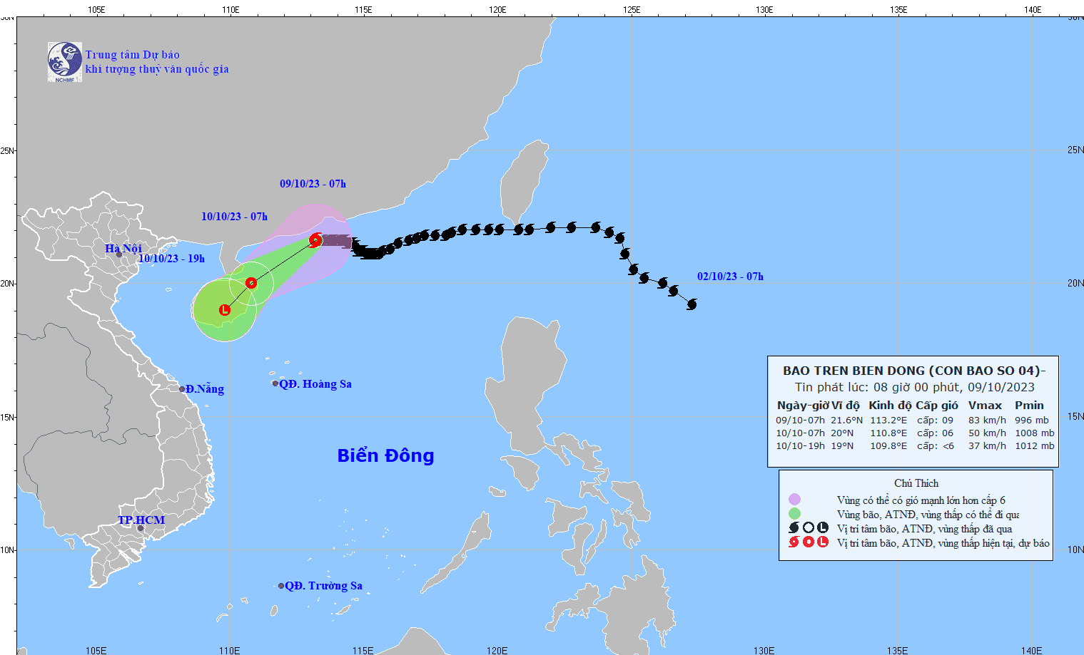
The direction of Typhoon Koinu (Photo: NCHF) |
By 7 p.m. on the same day, the storm is expected to further weaken into a low-pressure system.
According to the National Center for Hydro-Meteorological and Hydrological Forecasting, at 7 a.m. on October 9, the storm's center was located at approximately 21.6 degrees North Latitude and 113.2 degrees East Longitude over the waters to the South of Guangdong Province in China. The strongest winds near the storm's center reached level 9 (75-88 km/h), gusting to level 12, and the storm was moving slowly in a westerly direction at a speed of about 5 km/h.
The forecast indicates that by 7 a.m. on October 10, the storm will track Southwestward at a speed of 10-15 km/h and diminish into a tropical depression, accompanied by strong winds at levels 6-7, occasionally gusting to level 9. By 7 p.m. on the same day, the storm is expected to further weaken into a low-pressure system.
Over the next 24 hours, the Northwestern waters of the North of the East Sea will encounter strong winds at levels 6-7. In the vicinity of the storm's center, very strong winds at levels 8-9, with gusts reaching level 12, will prevail, leading to very rough seas.
Additionally, as a result of the reinforced cold air mass, starting from the early hours of October 10, the waters in the Gulf of Tonkin will encounter strong northeasterly winds at level 6, gusting to level 8, leading to rough sea conditions.
Wave heights in the North of the East Sea are between 2-3 meters, while in the vicinity of the storm's center, wave heights reach 3-5 meters. Starting from the morning of October 10, the Gulf of Tonkin will experience wave heights between 2-3 meters.
Alert for flooding, landslides, and soil erosion
Between 9 p.m. yesterday and 3 a.m. today, Gia Lai and Dak Lak provinces received moderate to heavy rainfall. Over the next six hours, rain is forecast to persist, with accumulated precipitation ranging from 20-40mm and over 60mm in some areas. There is a high risk of flooding in rivers and small streams, along with the potential for landslides on hilly terrain.
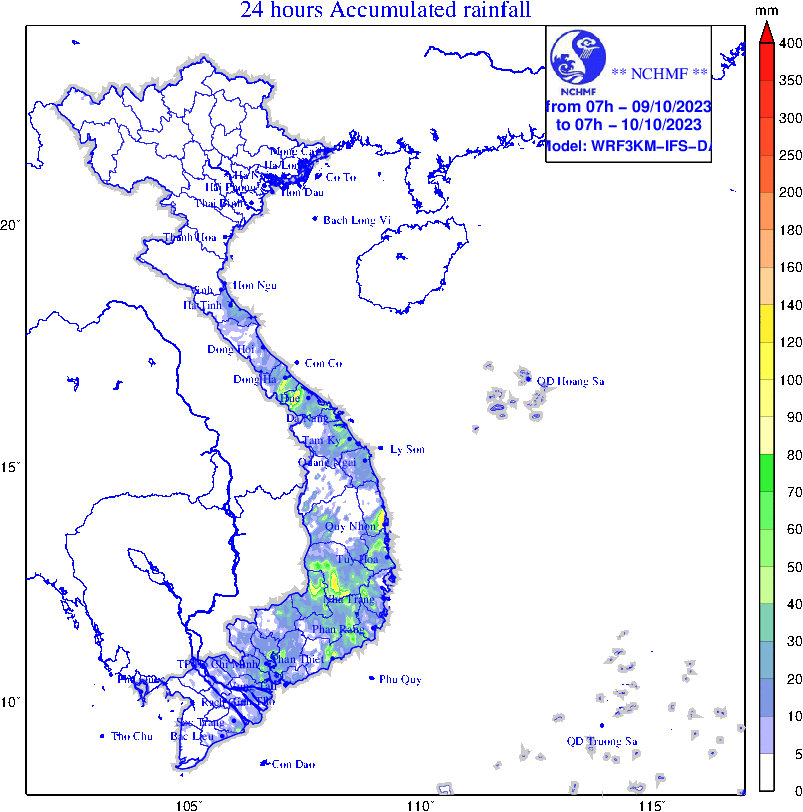 |
The map of risk of flash floods and landslides in different areas |
From 2 a.m. to 8 a.m. this morning, Phu Yen Province experienced moderate to heavy rainfall, sometimes torrential rain. Over the next six hours, rain is expected to continue, with accumulated precipitation ranging from 10-30mm on average and, in some areas, exceeding 50mm. There is a high risk of floods occurring in rivers, small streams, and landslides on hilly slopes.
Forecast for thunderstorms, localized heavy rain, lightning, hail, and strong winds
Last night and early this morning, regions spanning from Ha Tinh to Da Nang, the Central Highlands, and the Southern region encountered episodes of rain showers and thunderstorms.
The forecast for the day and night of October 9 is as follows: The Central region will have showers and thunderstorms, with some areas receiving moderate to heavy rainfall, ranging from 10-30mm and, in some places over 60mm. The South Central Coast, the Central Highlands, and the Southern region will have scattered showers and thunderstorms, with some areas experiencing moderate to heavy rainfall in the range of 10-30mm and exceeding 70mm in some locations (with the heaviest rainfall expected during the evening and nighttime).
