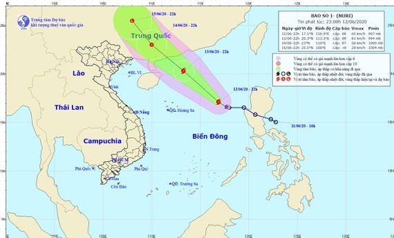
The tropical depression was centered at around 200 kilometers from the westward of the Luzon Island with maximum speed of 15-20 kilometers an hour.
It is expected that the tropical low pressure system would turn into the storm on Saturday.
Tomorrow, the storm is forecast to enter the mainland of Guangdong Province (China) with the gusty winds of level 8-12.
Currently, all vessels on the Northern part of the East Sea including the Paracel Island are warned in dangerous areas.
Shower spells along with thunderstorm, cyclone, lightning, hail and strong wind will travel the Southern and Central Highlands region from June 13-22. Meanwhile, the extreme hot weather in the Northern region will last until June 14.


)


