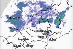
According to international meteorological agencies, including the Joint Typhoon Warning Center under the United States Navy and the Global Forecast System (GFS, U.S.), a low-pressure system over the Philippines moved into the East Sea this morning on August 27.
By midday, Vietnam’s National Center for Hydro-Meteorological Forecasting reported that the system had strengthened into a tropical depression after entering the East Sea.
")
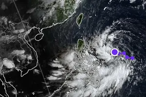
At 10 a.m., the center of the tropical depression was located near 17.7 degrees North latitude and 119.0 degrees East longitude with maximum sustained winds of 40–50 kilometers per hour, gusting up to 65 kilometers per hour. The system is moving west-southwest at 10–15 kilometers per hour.
Within the next 24–48 hours, the depression is expected to strengthen further, move faster and approach the Paracel Islands.

By 10 a.m. on August 28, the tropical depression will be about 410 kilometers east of the Paracel Islands with winds of 40–60 kilometers per hour, gusts up to 75 kilometers per hour.
By 10 a.m. on August 29, the system will be over the Paracel Islands, with sustained winds around 55–65 kilometers per hour, gusts up to 75 kilometers per hour. Over the next 48–72 hours, the system will continue moving westward at 10–15 kilometers per hour.
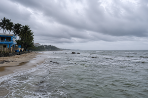
The northeastern waters of the East Sea will see winds of 40–60 kilometers per hour with gusts up to 75 kilometers, resulting in huge waves up to 2–4 meters and rough sea.


)