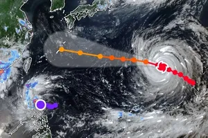
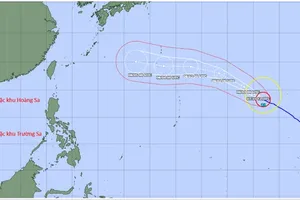
As updated by the National Center for Hydro-Meteorological Forecasting on the afternoon of December 2, the tropical depression has weakened to force 6 winds (equivalent to 39–49 kilometers per hour), with gusts up to force 8, moving slowly in a south–southwest direction at about 5 kilometers per hour.
On December 3, the system is expected to weaken further into a low-pressure area, below level 6, over the waters between Dak Lak and Khanh Hoa.
Meanwhile, a cold air mass is moving south over the Northern region. From the night of December 3, both the Northern and North-Central regions will experience cold weather, with high mountainous areas in the North experiencing severe cold. Lowest temperatures are forecast at 13–15 degrees Celsius in the Northern mountains, below 11 degrees Celsius in high mountains, 14–17 degrees Celsius in North-Central regions, and 15–18 degrees Celsius in the capital city of Hanoi.
Due to the dual effects of the cold air mass and the circulation of the tropical depression, along with upper-level easterly winds, areas including Hue City, Da Nang City, the eastern part of Quang Ngai Province, Dak Lak and Khanh Hoa will experience moderate to heavy rain, with localized very heavy rain. Rainfall is expected at 40–100 mm, locally exceeding 150 mm, on December 3.
The National Center for Hydro-Meteorological Forecasting has also issued a report assessing Vietnam’s weather outlook for December 2025. According to the report, one or two storms or tropical depressions are likely to appear over the East Sea, accompanied by cold air that may cause severe cold, especially in the Northern mountainous areas.
The Ho Chi Minh City People’s Committee has issued an urgent directive, requiring relevant departments, agencies and localities to implement decisive measures in response to the high tide expected to reach its peak in December.

Forecasts indicate that the peak will occur on December 5, with water levels at Thu Dau Mot station potentially reaching 1.75–1.76 meters and at Phu An station 1.63–1.67 meters, exceeding alarm level 3.
The city has assigned the Ho Chi Minh City Department of Agriculture and Environment and wards and communes the primary responsibility for protecting vulnerable areas; regularly informing residents about tidal developments; and urgently reviewing and reinforcing dikes and embankments. Additionally, the city also requires reservoir management units to regulate water releases to avoid the combined adverse effects of peak tides, heavy rain and floodwater discharge.
The municipal Department of Agriculture and Environment also issued an official letter requesting wards and communes to proactively inspect dikes, embankments, drainage systems and tide-control sluice gates in vulnerable areas.
The National Center for Hydro-Meteorological Forecasting reported that early on December 3, a cold air mass is moving towards Northern Vietnam.
According to meteorologists, by midday on December 3, the cold air began affecting the Northeast region, then spreading to the North-Central, Northwest, and northern parts of the mid-Central region.