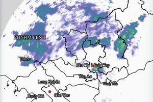
The National Center for Hydro-Meteorological Forecasting on the morning of November 25 reported that at 7 a.m., the center of the tropical depression was located at approximately 10.3 degrees North latitude and 123.1 degrees East longitude, over the central Philippines. The maximum wind speed near the center was at category 7 (equivalent to 50–61 kilometers per hour), with gusts at category 9. The system is moving west-northwest at 20–25 kilometers per hour.
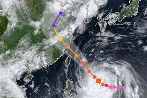
Meteorologists indicate that from November 25 to November 26, the tropical depression will continue moving west-northwest at a maximum speed of 25 kilometers per hour, enter the East Sea, the eastern waters of the middle of the East Sea, and may intensify into a force-8 storm with gusts up to category 10.
From November 26 to the morning of November 27, the storm is expected to maintain its west-northwest direction at about 15 kilometers per hour and may strengthen to categories 9–10, with gusts up to category 12 over the middle of the East Sea. Afterwards, it will shift mainly westward at 10–15 kilometers per houre and may continue strengthening.

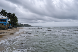
The National Center for Hydro-Meteorological Forecasting warns that from the evening of November 25, both the eastern waters of the middle of the East Sea and the northeastern waters of the southern East Sea will see increasing winds of categories 6–7; areas near the storm’s center may experience categories 8–9 with gusts up to category 11, and high waves of three to five meters. The sea will be very rough.
From around the afternoon of November 26 to November 28, the middle of the East Sea and the northern waters of the southern East Sea, including northern areas of the Spratly archipelago, may be affected by winds of categories 10–11, with gusts up to category 14.
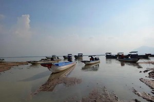
Vessels operating in these hazardous areas may face thunderstorms, waterspouts, strong winds and huge waves.


)