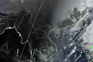
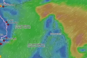
As updated by the National Center for Hydro-Meteorological Forecasting (NCHMF) at 4 a.m. on October 20, the storm’s center was near 17.5 degrees North latitude and 117.2 degrees East longitude, roughly 540 kilometers per hour east-northeast of the Paracel Islands. The storm is packing sustained winds of category 9 (equivalent to 75–88 kilometers per hour) and gusts up to category 11 (100 kilometers per hour), moving northwest at a speed of around 25 kilometers per hour.
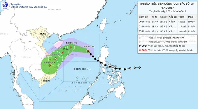
The National Center for Hydro-Meteorological Forecasting stated that typhoon No. 12 would maintain a complicated track over the next few days, potentially strengthening further before gradually weakening.
From October 20 through October 21, the tropical storm is expected to move west-northwest at 20 kilometers per hour, with winds increasing to force 11 (100–120 kilometers per hour) and gusts to level 13. It will then turn southwestward from October 21 to October 22, slowing to about 10 kilometers per hour, with winds around category 10–11, gusting to category 13.
The danger zone includes western parts of the northern East Sea, covering the Paracel Archipelago and coastal waters from Hue to Quang Ngai.
Between October 22 and the morning of October 23, the storm will linger offshore between Hue and Quang Ngai, gradually weakening to force 8, with gusts up to force 10.
The national weather bureau noted that the interaction between the storm’s circulation, cold air, easterly disturbances and mountainous terrain will trigger prolonged, widespread rainfall across Ha Tinh to Quang Ngai from October 22 to October 27. Some areas may experience extreme downpours, posing a high risk of flash floods and landslides in mountainous regions.
Amid the complicated weather conditions, local authorities are urged to prepare flood-response measures, as river levels from Quang Tri to Quang Ngai could reach or exceed level 3 flood warnings.

