The National Center for Hydro-Meteorological Forecasting reported that in the wake of storm No.9 (Ragasa) making landfall in Northern Vietnam, storm No.10 (Bualoi) is set to enter the East Sea, directly affecting the central and northern waters as well as parts of the central mainland.
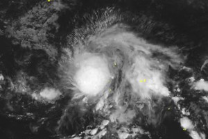
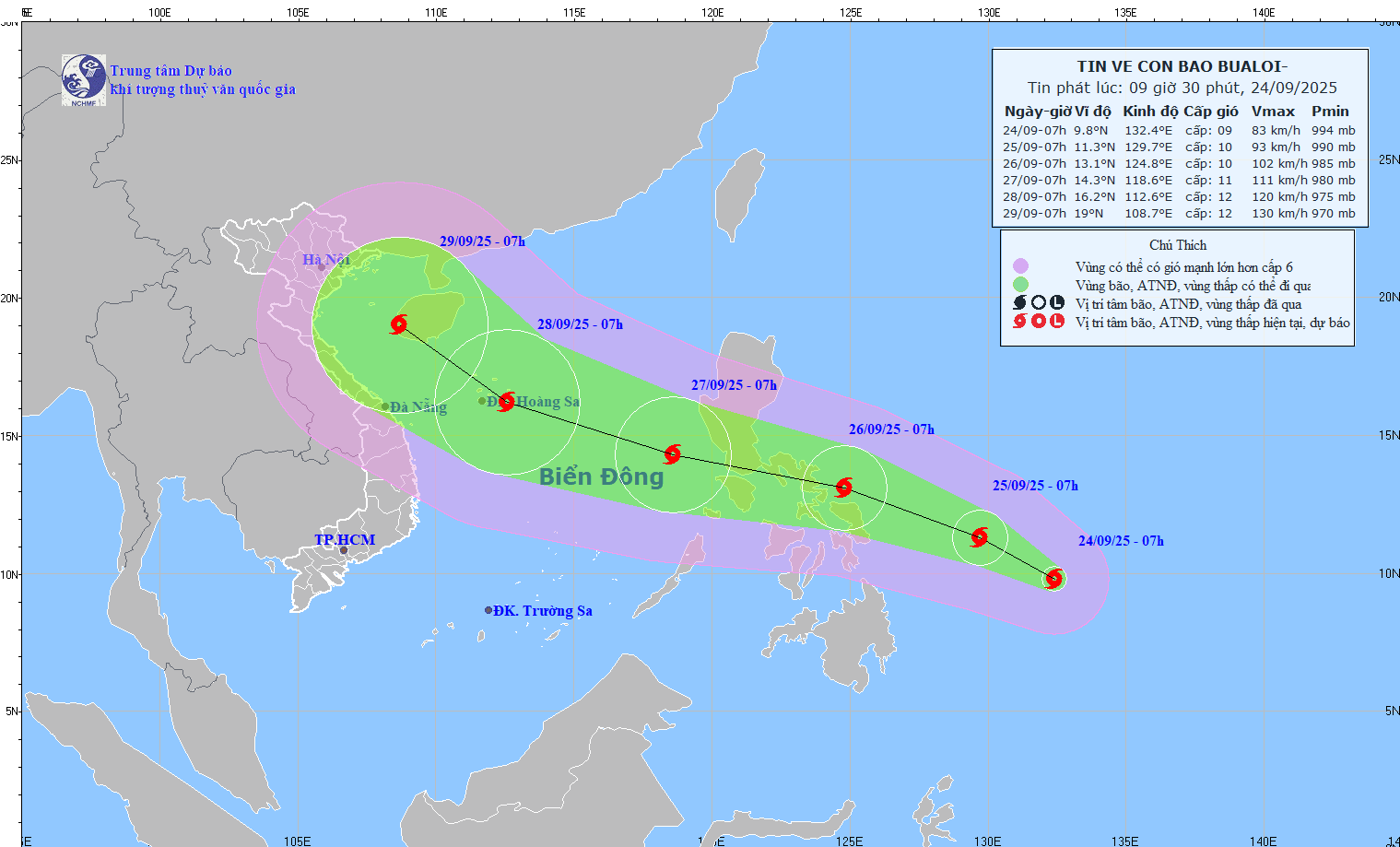
From late September 23 to early September 24, a tropical depression east of the Philippines strengthened into a storm, internationally named Bualoi. By the morning of September 24, its eye was located near 9.8 degrees North latitude and 132.4 degrees East longitude, packing maximum sustained winds of level 9 (75–88 km/h), gusting up to level 11, and moving west-northwest at about 15 km/h.
Forecasts indicate that by the night of September 26—one day earlier than previously anticipated—the storm will enter the East Sea and officially become Vietnam’s 10th named storm of 2025.
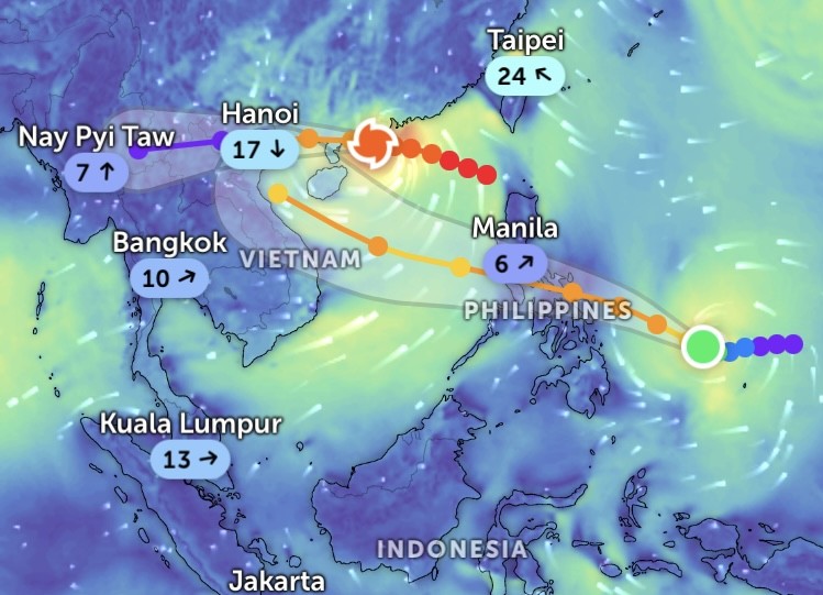
Over the next 24 to 72 hours, Bualoi is expected to intensify steadily. By 7 a.m. on September 25, its center will likely be around 11.3 degrees North and 129.7 degrees East, reaching level 9–10 with gusts up to level 12. By the morning of September 26, it will strengthen further to level 10, gusting level 12, and by September 27 it could reach level 11, with gusts up to level 14. Meteorologists warn the storm may escalate to level 12 or beyond.
In the subsequent 72 to 120 hours, Bualoi is projected to accelerate west-northwestward at 20–25 km/h while continuing to intensify.
The forecasting center cautioned that from the evening of September 26, strong winds of level 6–7 will begin sweeping the northeastern and central East Sea, increasing to level 8–9. Areas near the storm’s center may see winds at level 10–11, gusting up to level 14, with waves reaching 5–7 meters and extremely rough seas. The northern and central East Sea has been designated a particularly hazardous zone for vessels.
