However, some international models predicted that the storm’s center would enter the East Sea as early as the night of October 3 (Vietnam time).
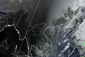
The National Center for Hydro-Meteorological Forecasting reported that on the morning of October 3, the center of storm Matmo was located at about 16.3 degrees North latitude and 122.7 degrees East longitude, over the waters east of Luzon Island in the Philippines. The maximum sustained winds near the storm’s center at 7 a.m. were level 9–10, equivalent to 75–102 kilometers per hour, with gusts up to level 13. The storm is moving west-northwest at around 25 kilometers per hour.
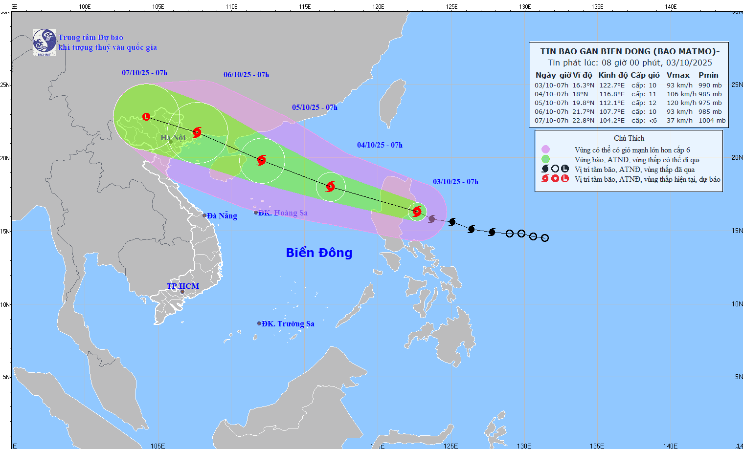
The National Center for Hydro-Meteorological Forecasting predicted that on the morning of October 4, the center of the storm may enter the East Sea, about 750 kilometers southeast of China’s Leizhou Peninsula. Once entering the East Sea, the storm is likely to strengthen to level 10–11, with gusts reaching level 14.
By the morning of October 5, the storm will continue moving west-northwest at 20–25 kilometers per hour, approaching the Leizhou Peninsula, with winds at level 12 and gusts up to level 15.
By the morning of October 6, Matmo is expected to move into the northern Gulf of Tonkin, with intensity reduced to level 10 and gusts at level 13, and it will tend to weaken gradually.
Vietnamese meteorologists noted that at present, storm No. 11 shows similarities to the recent storm No. 9, internationally named Ragasa.
International forecasting models have also recorded similar developments.
The Japan Meteorological Agency (JMA), the Joint Typhoon Warning Center (JTWC) and the global GFS model all predicted that storm Matmo would intensify after crossing Luzon Island as it enters the East Sea from the evening of October 3 (Vietnam time), thanks to high sea surface temperatures and favorable atmospheric conditions.
On the morning of October 3, the Philippine meteorological agency (PAGASA) upgraded Matmo to a severe tropical storm and issued warnings of strong winds and heavy rainfall for the Northern region of the country.
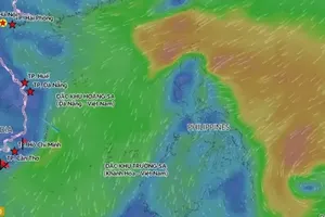
According to the National Center for Hydro-Meteorological Forecasting of Vietnam, from midday and afternoon of October 3, strong winds will gradually increase in the northeastern East Sea, reaching levels 6–7, later strengthening to levels 8–9. Areas near the typhoon’s center may experience winds of levels 10–11 with gusts up to level 13, waves 4–6 meters high, and extremely rough seas.
From October 4 to October 5, the northern part of the East Sea is expected to experience winds of levels 11–12, with gusts reaching level 15. Vessels operating in the hazardous zone face risks of thunderstorms, strong winds and high waves.
