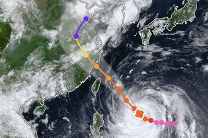
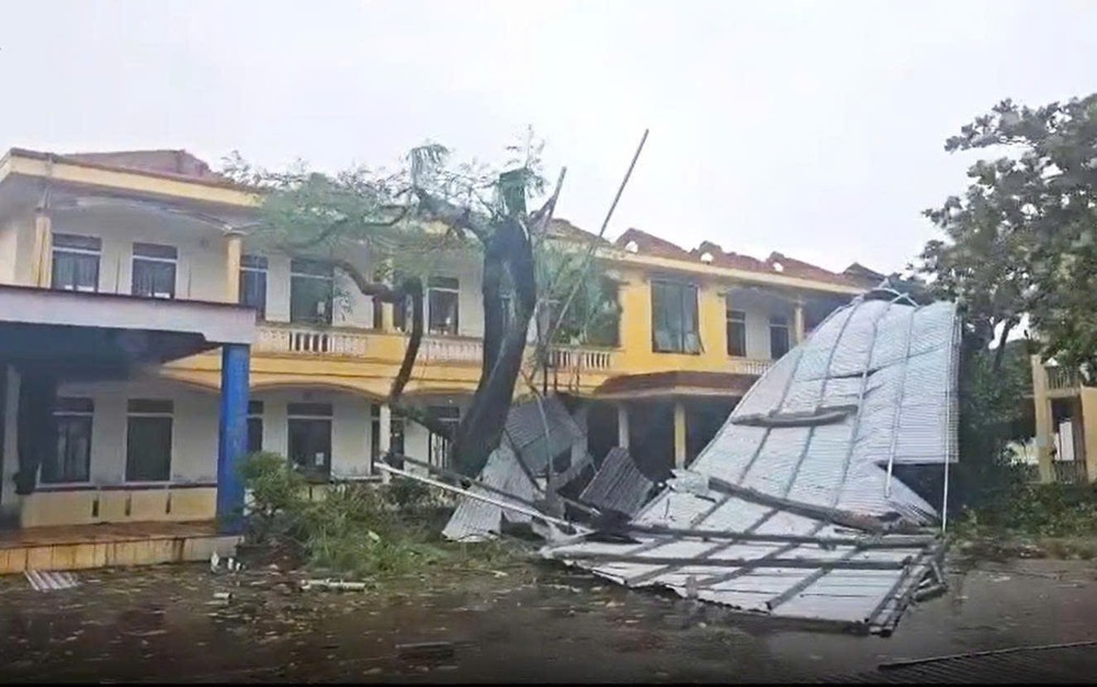
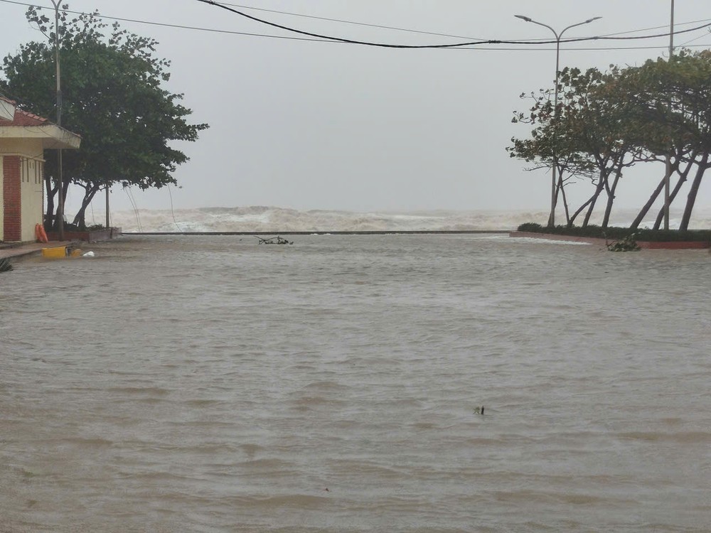
According to the National Center for Hydro-Meteorological Forecasting, as of 2 p.m., the storm’s center had moved onto the mainland of the North-Central region. At landfall, maximum sustained winds near the eye reached level 13, at 134–149 km/h, with gusts up to level 16.
Hanoi and many Northern localities experienced relentless, torrential downpours between 11 a.m. and 2 p.m.

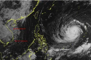
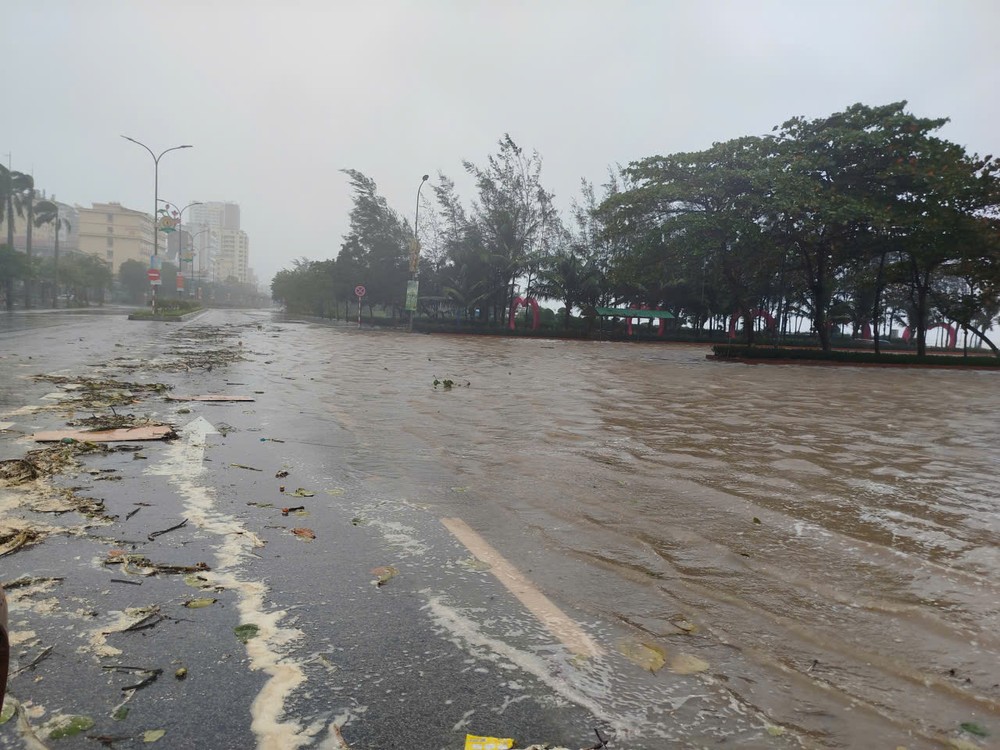
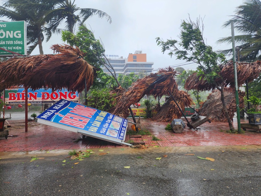
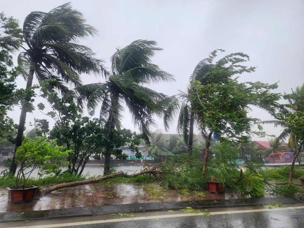
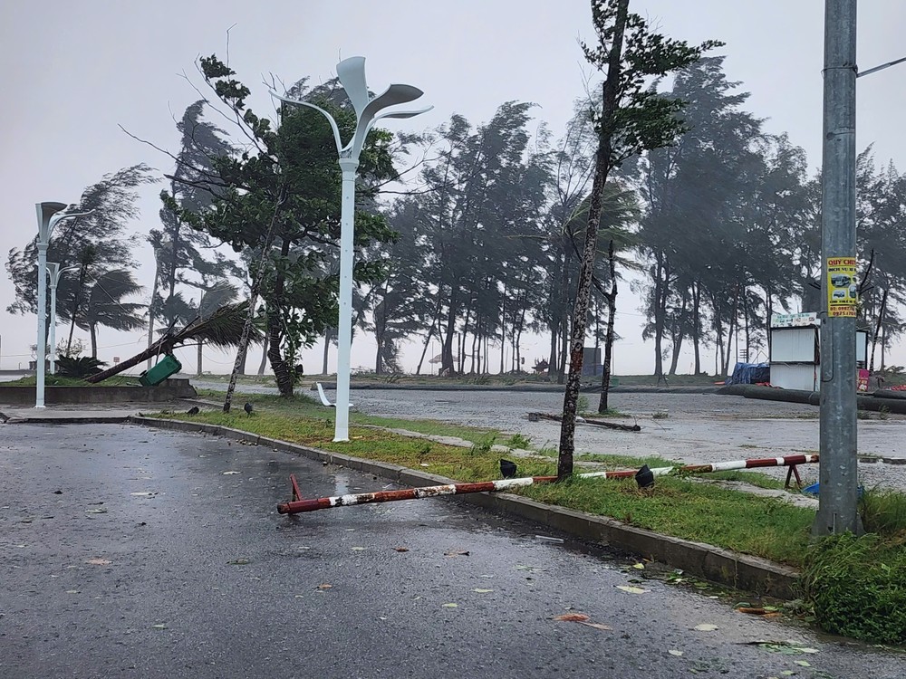
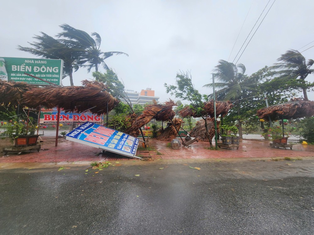
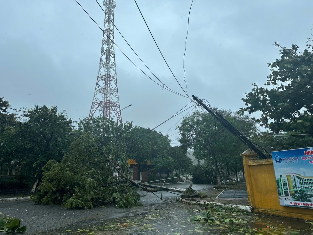
Under the impact of storm No.5, coastal and lowland areas of the Red River Delta and the North-Central Coast have been battered by strong winds, heavy rain, and rising sea levels.
Wind readings at major stations were recorded as follows: Bach Long Vi (Hai Phong) — level 7 (50-61 km/h), gusting to level 9 (75–88 km/h); Co To (Quang Ninh) — level 7, gusting to level 10 (89–102 km/h); Bai Chay (Quang Ninh) — level 6, gusting to level 8 (62-74 km/h); Van Ly (Ninh Binh) — level 8, gusting to level 9. In Nghe An, winds reached level 7, gusting to level 9 in Dien Chau; level 7, gusting to level 12 (118-133 km/h) in Quynh Luu; and level 8, gusting to level 11 (103–117 km/h) at Hon Ngu.

In Ha Tinh, winds were recorded at level 7, gusting to level 9 in Hoanh Son; level 7, gusting to level 11 in Ky Anh; and gusting to level 8 in Cam Nhuong. On Con Co Island (Quang Tri), winds reached level 6, gusting to level 8.
Speaking to the press at noon on August 25, Mr. Mai Van Khiem, Director of the National Center for Hydro-Meteorological Forecasting, warned that in the wake of storm Kajiki, extremely heavy rainfall would blanket both Northern and Central regions as massive storm clouds move inland.

The NCHMF reported that heavy rains are expected to continue from the afternoon of August 25 until the end of August 26. The Northern midlands, Red River Delta, Lao Cai, Son La, and provinces from Thanh Hoa to Quang Tri will experience widespread downpours, with rainfall generally ranging from 70 to 150 millimeters, and in many places exceeding 250 millimeters.
In particular, from Thanh Hoa to Northern Quang Tri, extremely heavy rainfall of 150 to 350 millimeters is forecast, with some areas surpassing 500 millimeters. Rainfall intensity may exceed 200 millimeters within three hours. Hanoi is expected to see moderate to heavy rain accompanied by thunderstorms on August 25 and 26; Da Nang will have occasional showers; HCMC will experience rain and thunderstorms mainly in the evening, with risks of whirlwinds and strong gusts.

Between August 25 and 27, Northern and Central Laos are also expected to see heavy rains of 100–250 millimeters, with localized totals in central Laos exceeding 500 millimeters, posing a high risk of flash floods and inundation.
)