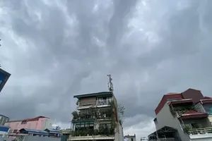
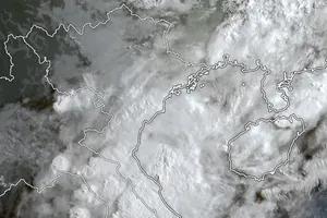
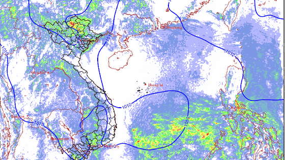
 Weather patterns in the next 48 hours. (Photo: nchmf.gov.vn)
1. Heavy rains in the mountainous areas and warning of tornadoes, lightning, hail, and strong winds in the North.
Today (September 19), the high-altitude wind convergence area of up to 5,000m is active in the Northern region.
It is forecasted that, due to the influence of the high-altitude wind convergence area, from September 19 to September 20, there will be scattered showers and thunderstorms in the North, with local moderate and heavy rains. Northern mountainous areas will see moderate, heavy, and violent rains and thunderstorms, with common rainfall of 100-150mm. Especially, the rainfall in Lai Chau, Lao Cai, Yen Bai, Ha Giang, Tuyen Quang, and Cao Bang provinces is up to 200mm. Heavy rains occur mainly in the evening, at night, and in the morning. During thunderstorms, there is a possibility of tornadoes, lightning, hail, and strong winds. There is a risk of flash floods, local landslides in mountainous areas, and local flooding in low-lying urban areas.
Warning of disaster risk due to tornadoes, lightning, and hail: Level 1.
2. Heavy rains and warnings of tornadoes, lightning, hail, and strong winds for provinces from Da Nang City to Binh Thuan, Central Highlands, and the South.
On the evening and night of September 18, there were showers and thunderstorms in the Central Highlands and the South, with local moderate and heavy rains. Some places had heavy rainfall (calculated from 7 p.m. on September 18 to 3 a.m. on September 19), such as Cat Tien in Lam Dong Province with 42mm, Nhon Trach in Dong Nai Province with 114mm, Cat Lai in Ho Chi Minh City with 98mm, Dau Tieng in Binh Duong Province with 68mm, Long Dien in Ba Ria-Vung Tau Province with 67mm, Go Dau in Tay Ninh Province with 60mm, Cao Lanh in Dong Thap Province with 66mm, and Phu Rieng in Binh Phuoc Province with 53mm.
On September 19, the intertropical convergence zone with an axis at about 10-13 degrees North latitude connects with a low-pressure area located at about 11.5-12.5 degrees North latitude and 112.5-113.5 degrees East longitude at 1 a.m. this morning.
It is forecasted that, due to the influence of the intertropical convergence zone along with the low-pressure area moving to the West, there will be showers and thunderstorms today and tonight in the sea area from Quang Ngai Province to Ca Mau Province and the area of the middle and the South of the East Sea, including the waters of the Spratly archipelago. During thunderstorms, there is a possibility of tornadoes and strong gusts of wind.
From September 19 to September 21, the low-pressure circulation will cause heavy rains for the provinces from Da Nang to Binh Thuan, the Central Highlands, and the South. There will be moderate rain, heavy rain, heavy downpour, and thunderstorms, with common rainfall of 100-200mm and over 250mm in some places. During thunderstorms, there is a possibility of tornadoes, lightning, hail, and strong winds. There is a risk of flash floods, local landslides in mountainous areas, and local flooding in low-lying urban areas.
Warning of disaster risk due to tornadoes, lightning, and hail: Level 1.


