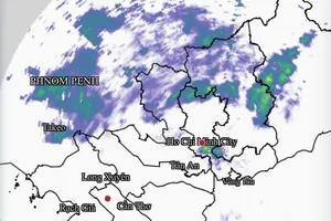
According to the Southern Regional Hydro-Meteorological Station, thunderstorms are developing over Ho Chi Minh City, bringing rain, lightning and whirlwinds to multiple wards and communes, including Vung Tau, Tam Thang, Rach Dua, Phuoc Hai, Long Hai, Dat Do, Ho Tram, Xuyen Moc, Binh Chau, Hoa Hoi, Binh My, Nhuan Duc, Thai My, An Nhon Tay, Tay Nam and Phu Tho Hoa.
")
Forecasts indicate that thunderstorms will continue to develop in the coming hours, bringing showers, lightning and sustained winds to the affected areas before spreading to nearby regions.
Rainfall totals are expected to range from 5 mm to 30 mm, with some places exceeding 30 mm. Heavy downpours may trigger localized flooding in several locations.
Temperatures will range from 24-27 degrees Celsius at the lowest to 31-34 degrees Celsius at the highest, with some areas above 34 degrees Celsius.
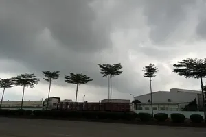
August 27 forecast alert that the Southern region will see mostly cloudy skies with only brief periods of sunshine. Showers and thunderstorms are likely around midday, afternoon, and evening, with some places seeing moderate to heavy rains.
Meteorologists caution that thunderstorms could bring dangerous conditions, including damaging winds, frequent lightning, hail and localized flooding in low-lying or poorly drained areas.
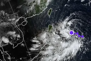
In the next two or three days, a tropical convergence zone connected to typhoon No. 5 is forecast to drive the storm ashore between Thanh Hoa and Quang Tri provinces by tomorrow afternoon. Additionally, the southwest monsoon will remain moderate to strong.


)