Rainfall recorded between 7 a.m. and 3 p.m. included 119.8 mm at Thoi Binh (Ca Mau), 95 mm at Tuyen Nhon (Tay Ninh), and 73.6 mm at Quang Khe (Lam Dong).
The agency warned that showers and thunderstorms will persist across Southern Vietnam and Lam Dong this evening and overnight, with rainfall of 10–30 mm and isolated totals exceeding 60 mm. From the afternoon of May 7 through May 8, Northern Vietnam, Thanh Hoa, and Nghe An are forecast to receive 20–40 mm of rain, with some locations likely to experience heavy to torrential downpours of over 100 mm.
Meanwhile, daytime temperatures in the South remain elevated at 33–35 degrees Celsius. The heat is intensifying convective activity in the afternoons. Combined with moisture from the southwest monsoon, this is fueling the rapid development of storm clouds, triggering widespread showers and thunderstorms.
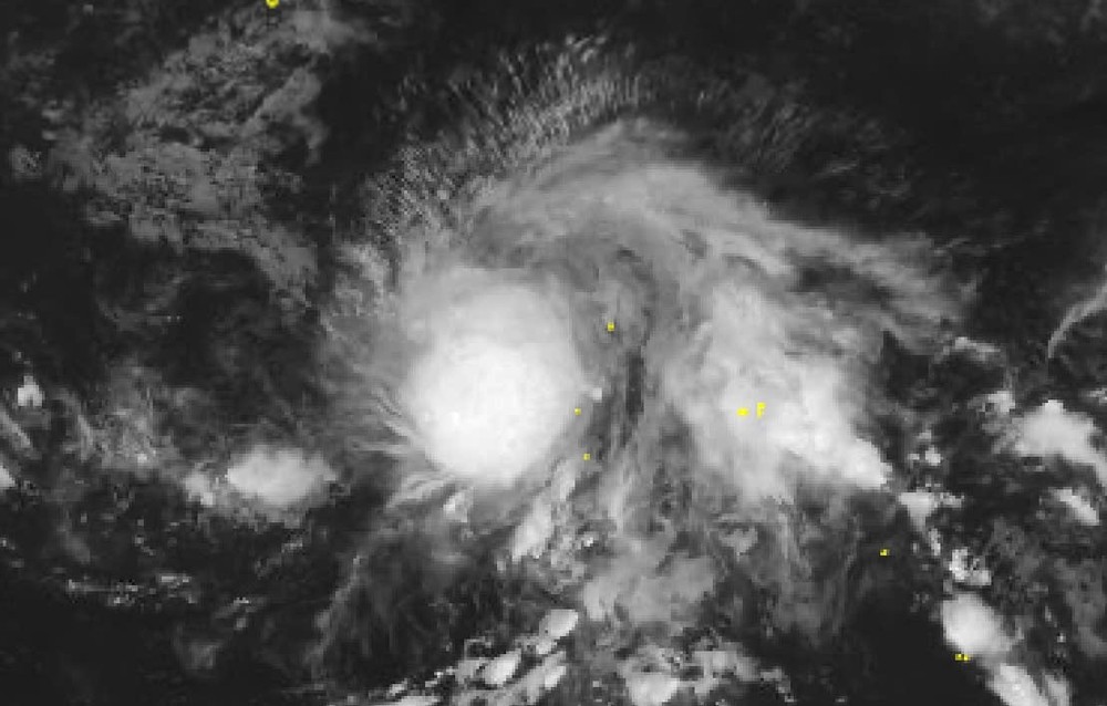
The National Center for Hydro-Meteorological Forecasting also said a tropical depression over the northwestern Pacific has strengthened into Typhoon Hagupit on May 6, the fifth storm to form in the basin during the 2026 typhoon season.
As of 1 p.m. on May 6, Hagupit’s center was located at approximately 8.4 degrees North latitude and 147.3 degrees East longitude, with sustained winds at level 8 and gusts up to level 10. The storm remains nearly 2,000 km East of the Philippines.
Over the next 24 hours, Hagupit is expected to move mainly westward at 5–10 km per hour before shifting west-northwest.
“The likelihood of Typhoon Hagupit crossing the Philippines into the East Sea is low,” the agency said, citing the presence of a subtropical high-pressure ridge at around 5,000 meters over the East Sea, which is expected to block the storm’s westward path.


